Tags
Anthony Lawson, Appalachia, Ben Creek, James Lawson, Joseph Hatfield, Logan County, Mingo County, Right Hand Fork, surveyor, Virginia, West Virginia, William A. Dempsey, William Collins


01 Monday Mar 2021
Posted in Wharncliffe
Tags
Anthony Lawson, Appalachia, Ben Creek, James Lawson, Joseph Hatfield, Logan County, Mingo County, Right Hand Fork, surveyor, Virginia, West Virginia, William A. Dempsey, William Collins
22 Monday Feb 2021
Posted in Hatfield-McCoy Feud, Logan
Tags
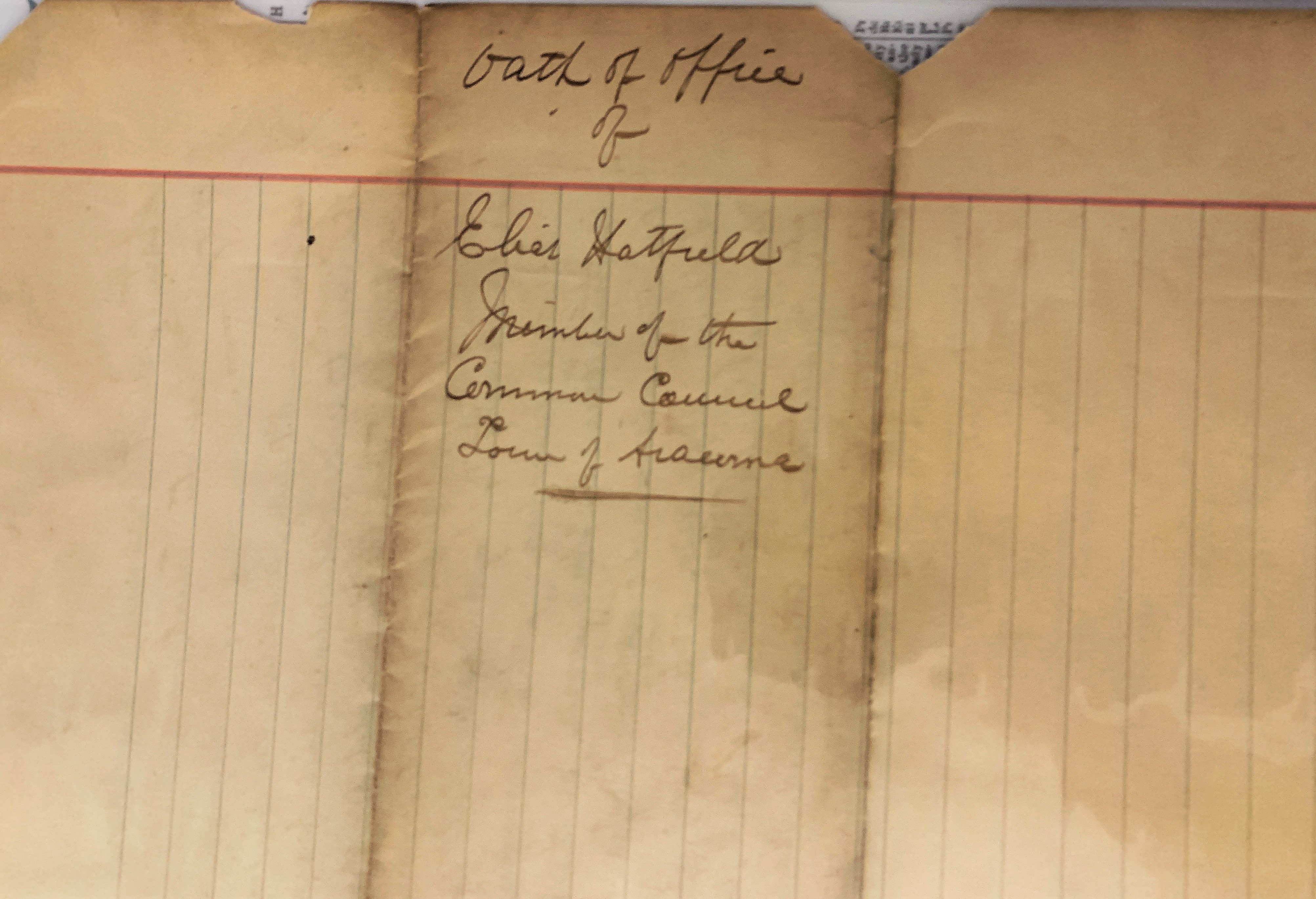
Alexander Cabell, Appalachia, Elias Hatfield, genealogy, Hatfield-McCoy Feud, history, Logan, Logan County, moonshining, West Virginia

19 Friday Feb 2021
Posted in Beech Creek, Big Sandy Valley, Matewan, Wharncliffe
Tags
Alex D. Trent, Beech Creek, Ben Creek, Bend Creek, Big Sandy River, David Mounts, Devil Anse Hatfield, Elias Hatfield, Elkhorn Sandy River Trust Company, genealogy, Glen Alum, Grapevine Creek, history, Isabella Rutherford, J.C. Williamson, J.D. Sergeant, Jacob Cline, Jacob Phillips, Jacob Smith, James Vance Jr., John Ferrell, John Francesco, John W. Deskins, Joseph Glen, Julius Williamson, justice of the peace, Kentucky, Lewis Ratcliff, Lewis Rutherford, Logan County, M.A. Ferrell, M.B. Lawson, Magnolia District, Michael A. Ferrell, Mingo County, Morehead, Philadelphia, Pigeon Creek, Richard Ferrell, Richard Maynard, Richard Ratcliff, Richard Ratliff, Right Fork, Roane County, Spring Fork, Spruce Fork, T.W. Blankenship, Thacker Creek, Tug River, Warren Alderson, West Virginia, William Ferrell, William S. Ferrell
What follows is a list of 1000-plus-acre tracts in Magnolia Township/District of Logan County, WV, for 1867, 1870, and 1886-1889…
1867
Jacob Cline’s Heirs, Logan County, 5000 acres, Sandy River
William Ferrell, Logan County, 3900 acres, Sandy River
Richard Maynard, Logan County, 3250 acres, Sandy River
David Mounts, Logan County, 3000 acres, Tug River and Tributaries
John Ferrell, Logan County, 2812 acres, Sandy River
Warren Alderson, Logan County, 2740 acres, Right Fork Ben Creek
John Ferrell, Logan County, 1814 acres, Pigeon Creek
Richard Ratliff, Logan County, 1340 acres, Stafford and Beech Creek
John W. Deskins, Logan County, 1305 acres, Thacker Creek and Sandy River
Warren Alderson, Logan County, 1300 acres, Spring Fork of Ben Creek
John Ferrell, Logan County, 1100 acres, Sandy River
Jacob Phillips, Logan County, 1000 acres, Sandy River
1870
Jacob Cline’s Estate, Logan County, 5000 acres, Sandy River
Richard Ferrell, Logan County, 3900 acres, On Sandy River
John Ferrell, Logan County, 3075 acres, 7 Tracts on Pigeon
David Mounts Estate, Logan County, 3000 acres, Tug Fork and Tributaries
Warren Alderson, Logan County, 2740 acres, Right Fork Ben Creek
Richard Maynard, Logan County, 2430 acres, On Sandy River
John W. Deskins, Logan County, 1305 acres, Turkey Sandy River
Warren Alderson, Logan County, 1300 acres, Spring Fork Ben Creek
William S. Ferrell, Logan County, 1100 acres, Sandy River
1876
Jacob Cline’s Heirs, Kentucky, 5000 acres, Grape Vine and Sandy
William S. Ferrell, Logan County, 3000 acres, Thacker and Sandy River
Warren M. Alderson, Kentucky, 2640 acres, Right Fork of Ben Creek
Isabella Rutherford, Logan County, 1600 acres, Sandy River
Michael A. Ferrell, Logan County, 1300 acres, Sandy River
Warren M. Alderson, Kentucky, 1175 acres, Spring Fork Ben Creek
Richard Ratcliff, Logan County, 1140 acres, Stafford Branch Sandy
Julius Williamson, Logan County, 1000 acres, Sandy and Branches
1886
William S. Ferrell, Logan County, 2650 acres
Warren Alderson, Morehead KY, 2640 acres, Sandy River
Lewis Rutherford, Logan County, 1600 acres
Jacob Smith, Mouth of Pond KY, 1500 acres
James Vance, Jr., Logan County, 1500 acres
J.D. Sergeant, Philadelphia PA, 1481 acres
Elias Hatfield, Logan County, 1431 acres
M.A. Ferrell, Logan County, 1300 acres
T.W. Blankenship, Roane County, 1200 acres
1887
William S. Ferrell, Logan County, 2650 acres, Thackers Creek and Sandy River
Warren Alderson, Morehead KY, 2640 acres, Sandy River
Anderson Hatfield, Logan County, 2360 acres, Grape Vine
J.D. Sergeant, Philadelphia PA, 1481 acres, Beech Creek
Elias Hatfield, Logan County, 1471 acres, Four tracts on Mates Creek
M.A. Ferrell, Logan County, 1300 acres, Sandy River
T.W. Blankenship, Roane County, 1200 acres, Spruce Fork of Ben Creek
1888
Anderson Hatfield, Logan County, 2656 1/2 acres, Grapevine Creek
William S. Ferrell, Logan County, 2650 acres, Thacker and Sandy
J.C. Williamson, Logan County, 1837 acres, Four tracts on Alum and Sandy River
Lewis Ratcliff, Logan County, 1600 acres, Sandy River
John Francesco, Logan County, 1500 acres, Grapevine and Thacker
Simpkins and M.B. Lawson’s Heirs, Logan County, 1500 acres, Richard Ratcliff Farm and Sandy River
Elkhorn Sandy R. Trust Co., Logan County, 1481 acres, Ben Creek and Sandy
J.D. Sergeant, Philadelphia PA, 1385 acres, Sandy River
M.A. Ferrell*, Logan County, 1300 acres, Sandy River
1889
Anderson Hatfield, Logan County, 2656 1/2 acres, Grapevine Creek
W.S. Ferrell, Logan County, 2650 acres, Thacker and Sandy River
J.C. Williamson, Logan County, 1837 acres, 4 Tracts on Alum and Sandy River
Lewis Rutherford, Logan County, 1600 acres, Sandy River
Jacob Smith, Logan County, 1500 acres, Richard Ratcliff’s Farm and Sandy River
John Francesco, Logan County, 1500 acres, Grape Vine
Elkhorn Sandy River Trust Company, Logan County, 1481 acres, Ben Creek and Sandy River
J.D. Sergeant, Philadelphia PA, 1385 acres, Sandy River
Joseph Glen, Logan County, 1377 acres, Tug River Below Mouth Bend
J.D. Sergeant, Philadelphia PA, 1354 1/4 acres, Mates Creek
J.D. Sergeant, Philadelphia PA, 1338 3/4 acres, Grapevine
M.A. Ferrell*, Logan County, 1300 acres, Sandy River
Alex D. Trent, Logan County, 1246 acres, Spring Fork Ben Creek
Note: On November 6, 1888, M.A. Ferrell was elected justice of the peace; his term commenced on January 1, 1889.
Source: Land Book 1866-1872, Land Book 1873-1874, Land Book 1880-1886, and Land Book 1887-1892.
19 Friday Feb 2021
Posted in Hatfield-McCoy Feud, Logan
Tags
Appalachia, Aracoma, Elias Hatfield, genealogy, Hatfield-McCoy Feud, history, Logan, Logan County, notary public, S.P. Kelly, West Virginia

18 Thursday Feb 2021
Posted in Big Sandy Valley, Hatfield-McCoy Feud, Matewan
Tags
Appalachia, Big Sandy River, Cap Hatfield, feuds, Grapevine Creek, Hatfield-McCoy Feud, history, J.D. Sergeant, Logan County, Nancy E. Hatfield, Philadelphia, Reece Browning, Tug Fork, West Virginia
The following land information is derived from Land Book 1880-1886, Land Book 1887-1892, and Land Book 1893-1899 at the Logan County Clerk’s Office in Logan, WV:
Anderson Hatfield, Jr.
No property listed in 1865-1885.
1886: Magnolia District
400 acres Grapevine Creek $1.25 per acre no building $[blank]
300 acres Grapevine Creek $1.25 per acre $30 building $315 total
[The 300-acre tract contained this additional note: “redeemed for 1884.”]
1887: Magnolia District
400 acres Grape Vine $1.25 per acre no building $500 total
300 acres Grape Vine $1.25 per acre no building $375 total
1888-1890: Magnolia District
No property listed for Cap.
[Note: On January 30, 1888, he transferred with others two tracts on Grapevine Creek, Sandy River worth $1.25 per acre with total value of $875 to J.D. Sergeant of Philadelphia, PA.]
1891: Logan District
Nancy E. Hatfield
75 acres Island Creek $2 per acre no building $150 total
[Note: This property was “transferred from Reece Browning.”]
1892-1893: Logan District
Nancy E. Hatfield
75 acres Island Creek $2.50 per acre no building $187.50 total
1894: Logan District
Nancy E. Hatfield
75 acres Island Creek, $2.50 per acre no building $188 total
18 Thursday Feb 2021
Posted in Big Sandy Valley, Hatfield-McCoy Feud
Tags
Amos Acord, Appalachia, Bill Staton, county clerk, crime, feuds, Hatfield-McCoy Feud, history, John Chafin, Logan County, Mingo County, murder, Sam McCoy, true crime, West Virginia

18 Thursday Feb 2021
Posted in Big Sandy Valley, Hatfield-McCoy Feud, Matewan
Tags
Appalachia, Ben Creek, Big Sandy River, Devil Anse Hatfield, genealogy, Grapevine Creek, H.R. Phillips, Hatfield-McCoy Feud, history, J.D. Sergeant, Johnse Hatfield, Johnson Hatfield, justice of the peace, Left Hand Fork, Levicy Hatfield, Lick Branch, Lick Fork, Logan County, Magnolia District, Mingo County, Nancy Hatfield, Philadelphia, Thacker Creek, Valentine Wall Hatfield, West Virginia
The following land information is derived from Land Book 1880-1886 and Land Book 1887-1892, as well as deed books, at the Logan County Clerk’s Office in Logan, WV:
Johnson Hatfield
No property listed in land books for 1865-1881.
On January 28, 1882, Anderson and Vicy Hatfield deeded 200 acres at Lick Fork of Grapevine Creek to Johnson Hatfield (all of Logan County) for $250. Began at a large rock near the creek bank just above the garden field at the mouth of Lick Fork, thence running out to the center of the point above Lick Fork…to the head of Lick Fork and down the top of the ridge between Grapevine and Thacker Creek… Anderson and Vicy Hatfield signed the deed. Justice Valentine Hatfield witnessed the deed on January 28, 1882.
No property listed in land books for 1883.
1884-1885: Magnolia District
Johnson Hatfield, Jr.
200 acres Lick Branch, Grape Vine $1.25 per acre no building $250 total
Johnson Hatfield, Sr.
200 acres Lick Branch, Grape Vine $1.25 per acre no building $250 total
[Note: Two entries exist in the land book for a Johnson Hatfield (Sr. and Jr.) in 1884-1885; this is likely the same person and the same property.]
1886: Magnolia District
No entry for him.
1887: Magnolia District
Nancy Hatfield
300 acres Grapevine, Sandy River $1.25 per acre no building $375 total
[Note: This property was transferred from Johnson Hatfield. Presumably, “Nancy Hatfield” is Johnse’s wife, the former Nancy McCoy.]
1888: Magnolia District
No entry for Johnson or Nancy Hatfield.
[Note: On January 30, 1888, Johnson Hatfield, Jr. transferred 500 acres on Grapevine, Sandy River (two tracts) worth $1.25 and total value of $625 to J.D. Sergeant of Philadelphia, PA.]
1889: Magnolia District
No property listed.
1890: Magnolia District
Nancy Hatfield
147 acres H.R. Fk Mates Creek $1 per acre no building $147 total
[Note: This may be Johnse’s wife, Nancy.]
1891: Magnolia District
No property listed.
[In 1891, “Jo Hatfield & wife” transferred 258 acres on Left Hand Fork Ben Creek worth $1 per acre and with total value of $258 to H.R. Phillips, trustee. This may or may not be Johnse Hatfield.]
18 Thursday Feb 2021
Posted in Hatfield-McCoy Feud, Huntington, Logan, Wayne
Tags
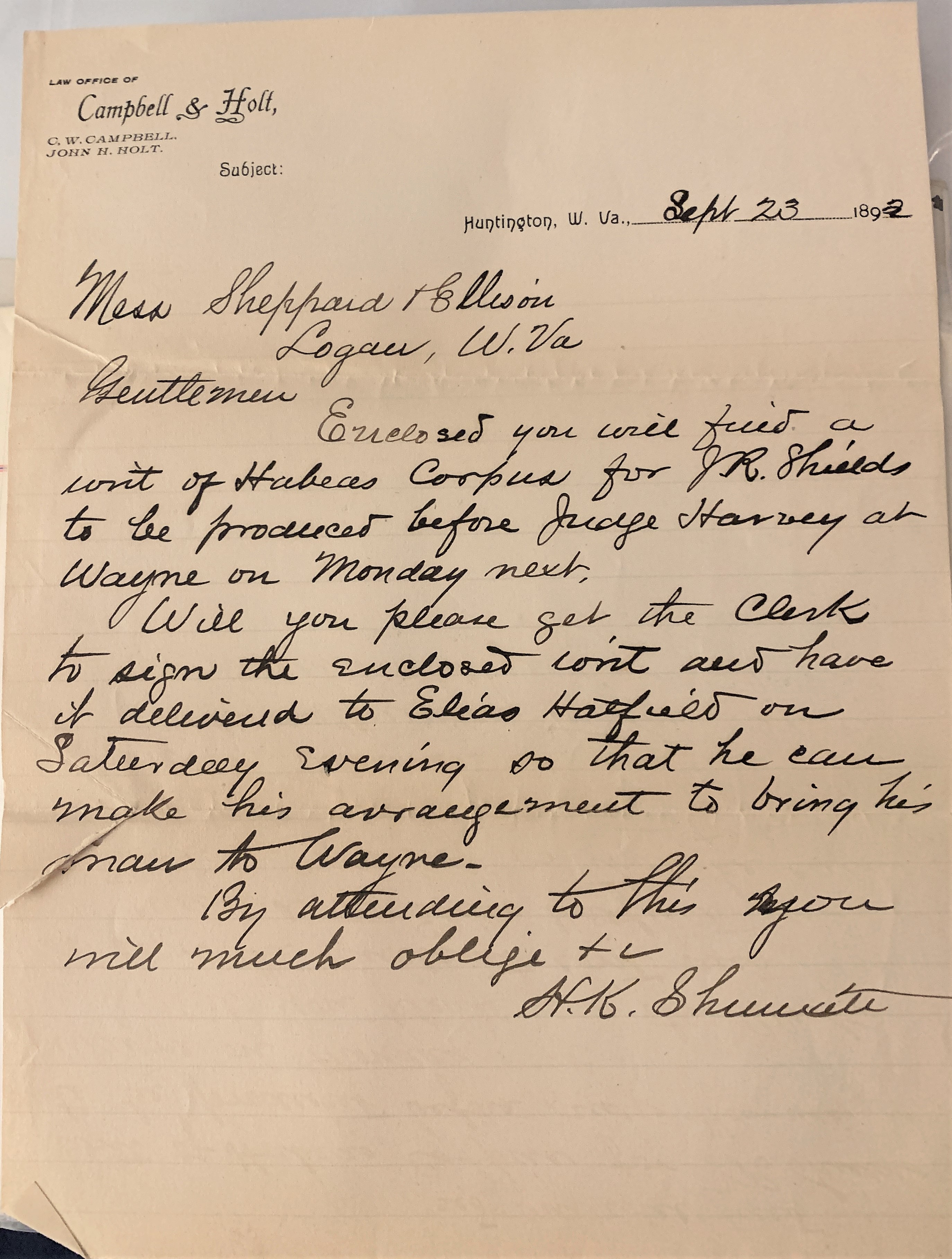
Appalachia, attorney, C.W. Campbell, Elias Hatfield, genealogy, H.K. Shumate, Hatfield-McCoy Feud, history, Huntington, J.R. Shields, John H. Holt, judge, Logan County, Thomas H. Harvey, Wayne County, West Virginia
16 Tuesday Feb 2021
Posted in Big Sandy Valley, Hatfield-McCoy Feud, Matewan
Tags
Appalachia, Double Camp Branch, Ellison Hatfield, Ephraim Hatfield, genealogy, H.R. Phillips, Hatfield-McCoy Feud, history, Logan County, Magnolia District, Mates Creek, Mingo County, West Virginia
The following land information is derived from Land Book 1880-1886, Land Book 1887-1892, and Land Book 1893-1899 at the Logan County Clerk’s Office in Logan, WV:
Ellison Hatfield
No property listed in 1865-1879.
1880: Magnolia District
50 acres Double Camp Fork, Ben Creek $0.25 per acre no building $12.50
300 acres Mates Creek $0.25 per acre no building $75 total
[Note: The 300-acre tract was transferred from Ephraim Hatfield.]
1881: Magnolia District
50 acres Double Camp Fork Mates Creek $0.25 per acre no building $12 total
276 acres Mates Creek $0.25 per acre no building $69 total
[Note: The reduction of the 300-acre tract is unexplained.]
1882: Magnolia District
The Hatfield page is missing.
1883: Magnolia District
No records are listed for this year.
1884: Magnolia District
50 acres Double Camp Br. Mates Creek $2.50 per acre $25 building $125 total
276 acres Double Camp Br. Mates Creek $1 per acre no building $276 total
20 acres Double Camp Mates Creek $1 per acre no building $20 total
[Note: The 50-acre and 276-acre tract is listed in the name of “Ellison Hatfield’s Heirs”. The 20-acre tract is listed in the name of Ellison Hatfield.]
1885: Magnolia District
50 acres Double Camp Branch, Mates Creek $2.50 per acre $25 building $125 total
276 acres Double Camp Branch, Mates Creek $1 per acre no building $276 total
50 acres Double Camp Branch, Mates Creek $2.50 per acre $30 building $125 total
1886: Magnolia District
50 acres Mates Creek $2.50 per acre no building $56 total
20 acres Mates Creek $1 per acre no building $130 total
1887-1889: Magnolia District
Ellison Hatfield
50 acres Mates Creek $2.50 per acre $30 building $125 total
20 acres Mates Creek $1 per acre no building $20 total
Ellison Hatfield’s Heirs
50 acres Double Camp, Mates Creek $2.50 per acre $25 building $125 total
276 acres Double Camp, Mates Creek $1 per acre no building $276 total
20 acres Double Camp, Mates Creek $1 per acre no building $20 total
[Note: In 1887, the latter three tracts are noted as “one yr back tax & interest.” In 1888, the latter three tracts are noted as “sold to Okeefe for tax.” In 1889, the latter three tracts are restored to Ellison Hatfield’s heirs.]
1890-1891: Magnolia District
Ellison Hatfield
50 acres Mates Creek $2.50 per acre $30 building $125 total
20 acres Mates Creek $1 per acre no building $20 total
Ellison Hatfield’s Heirs
50 acres Double Camp, Mates Creek $2.50 per acre $25 building $125 total
276 acres Double Camp, Mates Creek $1 per acre no building $276 total
28 acres Double Camp, Mates Creek $1 per acre no building $28 total
1892: Magnolia District
Ellison Hatfield
50 acres Mates Creek $2.50 per acre $25 building $125 total
20 acres Mates Creek $2 per acre $40 building $175 total
Ellison Hatfield’s Heirs
50 acres Double Camp, Mates Creek $3.50 per acre $30 building $175 total
276 acres Double Camp, Mates Creek $3.50 per acre no building $966 total
28 acres Double Camp, Mates Creek $3.50 per acre no building $98 total
1893: Magnolia District
Ellison Hatfield
50 acres Mates Creek $2.50 per acre $30 building $125 total
20 acres Mates Creek $2 per acre no building $40 total
[In 1893, Ellison Hatfield’s heirs by commissioner transferred 250 acres on Mates Creek worth $3.50 per acre and total value of $875 to H.R. Phillips, trustee.]
16 Tuesday Feb 2021
Posted in Battle of Blair Mountain, Coal, Huntington, Logan
Tags
Appalachia, Battle of Blair Mountain, Charles Town, Chesapeake & Ohio Railroad, coal, Democratic Party, deputy sheriff, Don Chafin, geography, history, Huntington, Logan, Logan Banner, Logan County, mine guards, politics, Republican Party, West Virignia
From the Logan Banner of Logan, WV, comes this editorial about mine guards, dated June 30, 1922:
MINE GUARDS OF LOGAN
The attorneys for the defense in the miners’ trials at Charles Town, which have been in progress for the past several weeks, have taken every opportunity of referring to the deputy sheriffs of Logan county mine guards as “thugs” and “two-gun men.”
Logan county is, and has been for several years, ruled by officers elected on the Democratic ticket. The Logan Banner adheres to the party of Lincoln, Grant, Roosevelt and Harding. It believes in the policy of the Grand Old Party and so long as that belief endures we will be found advocating the doctrines as preached by the leaders of this political organization.
Politics has no place in the discussion of the so called mine guard system in Logan county. We hold the love and respect of our homes far above any reverence to political parties and when the good name of Logan is attacked we forget political lines and join with the good people of this vast community in resenting any reflection on the fair name of Logan.
It has always been a mystery to us why the demand for the abolishment of the extra number of deputy sheriffs in this county should come from parties who are non-residents of the county? Who has demanded their abolishment? What cry has been heard from Logan county for aid? What facts have been presented of any unlawful acts committed at the hands of officers in this county?
Logan is filled with men of the highest type of intelligence. Likewise, they have many, many men here who are as brave as any men to be found in the nation. These men would not, for an instant, be a party to crimes in the county without raising their voices in protest. When it is all sifted down, it is found the hue and cry for a change of conditions is raised by those other than citizens of Logan county. Here are four points that must be borne in mind when considering Logan county:
Logan is situated among the mountains with but one natural outlet. This is by way of the C. & O. branch line to Huntington. The county is naturally divided by creeks, valleys, and branch railway lines. On these can be found many operations, employing hundreds of laborers, and to successfully cope with the lawless the sheriff is naturally required to employ more than the usual amount of deputies.
If Logan county was situated on the trunk line of any railway system, it would be a much easier task to supply the mines with labor, but due to the fact that it is far removed from any other section of the state and that in order to reach any other point, east, west, north or south it becomes necessary to travel over a distance of 75 miles to Huntington, labor is hard to obtain.
In securing this labor to fill the requirements of the large corporations operating here, it is necessary to visit the employment agencies located in the larger cities. Anyone acquainted with these agencies recognize the fact they are not scrupulous about whom they list, and the natural consequence is that many brought here on transportation are recognized criminals and members of all nationalities. Not all of them, thank goodness, are of the lawless class, but many are. They require constant watching and close scrutiny to see that their criminal tendencies do not become too pronounced. In order to do this it becomes imperative to have a large force of officers.
In view of the fact that there are 142 operations in this county and that approximately 50,000 people are laboring within our borders it can be readily seen that 35 deputies are a comparative small force to exercise supervision over such a huge population. Should a riot break out within our county it would require at least eight hours to obtain help from any section of the state. The fact that Logan needs as large a force of officers was amply attested when the armed march was made on Logan last August.
This article is not written in the defense of Don Chafin or his deputies. They need no defense at our hands. It is not written in defense of a policy adopted by any political party in the county. Regardless of the political affiliations of the sheriff, the Banner would earnestly recommend to anyone, be he the most rabid Republican in the county, if they should be sheriff, the retention of an official force as large as is now employed.
A great hue and cry has been raised because the salaries of these officers have been paid by the coal operators. Let us for a moment realize that the coal industry in the county is the sole industry in our midst. Upon the shoulders of these operators fall the burden of the peace and happiness of their employees. It is in order to furnish these employees protection and security that they have gone into their pocket books and paid for this protection. Who objects? Have you heard a taxpayer in Logan county object? Not one. They are perfectly willing that this cost shall be borne by the operators. They might as well object to the operators subscribing to better schools in Logan. Also voice opposition to better roads, the burden of which falls on the shoulders of the operators.
No one has heard a Macedonian cry from Logan for aid? Not even when union fields of the state were appealing for bread. If there was ever an example of the benefits of the non-union shop plan it was simply exemplified during the recent dull period. Logan worked and fared well. We have no ills to cure nor any abuses that need redress. The propaganda put forth pour from the foul mouths of others than citizens of Logan county and we beseech them to busy themselves with affairs other than ours, for we are perfectly able to take care of ourselves, and when we need their assistance, or advice, we will call for them loud and long.
16 Tuesday Feb 2021
Posted in Atenville, Guyandotte River, Little Harts Creek
Tags
Appalachia, Charles I. Stone, Dry Branch, Evermont Ward, genealogy, Guyandotte River, history, James Lawson, Joel Elkins, John Brooks, Lincoln County, Little Harts Creek, Logan County, Reece W. Elkins, surveyor, Virginia, West Virginia

15 Monday Feb 2021
Posted in Atenville, Big Creek, Hamlin, Harts, Huntington, Logan, Man, Sand Creek, Whirlwind
Tags
A.B. Gillan, Annie Dingess, Appalachia, Atenville, Beatrice Adkins, Bessie Adkins, Bill Adkins, Bill Farris, Caroline Brumfield, Chesapeake & Ohio Railroad, Cora Adkins, Fred Shelton, Hamlin, Harriet Dingess, Harts, Herbert Adkins, Huntington, Inez Adkins, Jessie Brumfield, Laura Lucas, Lincoln County, Logan, Logan Banner, Logan County, Man, Myrtle Mobley, Nora Brumfield, Sadie Powers, Sand Creek, Sesco Messinger, Sylvia Shelton, Tom Brumfield, Vina Adkins, West Virginia, Whirlwind
An unnamed correspondent from Harts in Lincoln County, West Virginia, offered the following items, which the Logan Banner printed on November 27, 1925:
Here comes Harts at the tip top again.
Mrs. Vina Adkins and children of Man are visiting relatives at Harts at the present time.
Mrs. Chas. Brumfield and children were the guests of her daughter, Mrs. Robert Dingess, of Whirlwind, Sunday.
Miss Sylvia Shelton and Laura Lucas of Sand Creek were calling on friends at Harts Monday.
Mr. Bill Faris is quite a popular fellow with all the girls at Harts now.
We wonder why Mr. Spencer is taking dinner with Mrs. Sadie Powers so often now?
Mrs. Herbert Adkins attended the circuit court at Hamlin the past week.
Miss Cora Adkins of Logan spent Sunday with home folks at Harts.
Mrs. Beatrice Adkins was shopping in Logan Saturday.
Miss Jessie Brumfield is progressing nicely with her school at Atenville.
Mr. Tom Brumfield and Sesco Messinger have opened up their new garage at Harts.
Miss Myrtle Mobley of Big Creek and Fred Shelton of Sand Creek were seen out walking through Harts Saturday evening.
Mr. A.B. Gillan, C. & O. operator of Huntington was calling on Miss Jessie Brumfield Monday evening.
Miss Harriet Dingess of Logan is visiting friends and relatives at Harts this week.
Combinations: Sadie and her red coat; Inez and bobbed hair; Bessie and her wrist watch; Nora and her powder puff; May and her purple dress; Tom in his garage; Bill and his grey suit; Jessie and her diamond ring.
Dear old Banner, we will see you again next week.
15 Monday Feb 2021
Posted in Fourteen
Tags
Bird Nelson, crime, Fourteen, Fourteen Mile Creek, genealogy, history, Lincoln County, Lizzie Tipton, Logan County, Nancy Ellen Nelson, Sherman Nelson, true crime, West Virginia

15 Monday Feb 2021
Posted in Big Sandy Valley, Hatfield-McCoy Feud, Matewan
Tags
Appalachia, Ephraim Hatfield, genealogy, Hatfield-McCoy Feud, history, Logan County, Magnolia District, Marks Branch, Mates Creek, Mingo County, Nancy Hatfield, Patterson Hatfield, Smith Hatfield, West Virginia
The following land information is derived from Land Book 1873-1874, Land Book 1880-1886, and Land Book 1893-1899 at the Logan County Clerk’s Office in Logan, WV:
Smith and Patterson Hatfield
No property listed in 1865-1877.
1878: Magnolia District
Smith and Patterson Hatfield
100 acres Mates Creek $4 per acre $25 building $400 total
[Note: This tract was transferred from Ephraim Hatfield in 1878.]
Smith Hatfield
25 acres Marks Branch, Mates Creek $0.20 per acre no building $5 total
1879: Magnolia District
No records for this year.
1880-1881: Magnolia District
Smith and Patterson Hatfield
100 acres Mates Creek $4 per acre $25 building $400 total
Smith Hatfield
25 acres Marks Branch, Mates Creek $0.20 per acre no building $5 total
[Note: In the 1880 census, widowed Nancy Hatfield lived with her son, Patterson.]
1882: Magnolia District
The Hatfield page is missing.
1883: Magnolia District
The page is mostly blank but does list:
Smith Hatfield 25 acres M__ Br of Mates Creek $2.50 per acre [rest is blank]
1884-1885: Magnolia District
Smith and Patterson Hatfield
100 acres Mates Creek $3 per acre $35 building $300 total
Smith Hatfield
25 acres Marks Br. of Mates Creek $2.50 per acre no building $62.50 total
1886: Magnolia District
Smith and Patterson Hatfield
100 acres Mates Creek $3 per acre no building $230 total
Smith Hatfield
25 acres Mack Branch, Mates Creek $2.50 per acre [blank]
1887-1888: Magnolia District
Smith and Patterson Hatfield
100 acres Mates Creek $3 per acre $35 building $300 total
Smith Hatfield
25 acres Marks Branch, Mates Creek $2.50 per acre no building $62.50 total
1889: Magnolia District
Smith Hatfield
25 acres Mark Branch, Mate Creek $2.50 per acre no building $65 total
Pat Hatfield
50 acres Mates Creek $3 per acre $35 building $150 total
1890: Magnolia District
Smith Hatfield
25 acres Mate Creek $2.50 per acre no building $65 total
50 acres Mate Creek $3 per acre $35 building $150 total
Patterson Hatfield
50 acres Mate Creek $3 per acre $30 building $150 total
1891-1892: Magnolia District
Smith Hatfield
25 acres Mate Creek $2.50 per acre no building $62.50 total
50 acres Mate Creek $3 per acre $35 building $150 total
Patterson Hatfield
50 acres Mate Creek $3 per acre $30 building $150 total
1893-1894: Magnolia District
Smith Hatfield
25 acres Mate Creek $2.50 per acre no building $62.50 total
50 acres Mate Creek $3 per acre $40 building $150 total
Patterson Hatfield
50 acres Mate Creek $2.50 per acre $40 building $125 total
13 Saturday Feb 2021
Posted in Big Sandy Valley, Hatfield-McCoy Feud
Tags
Appalachia, Beech Creek, Big Sandy River, Doc Mahon, Double Camp Branch, Ephraim Hatfield, genealogy, Hatfield-McCoy Feud, history, J.D. Sergeant, Jane Hatfield, Logan County, Magnolia District, Mingo County, Philadelphia, Valentine Wall Hatfield, West Virginia
The following land information is derived from Land Book 1873-1874, Land Book 1880-1886, Land Book 1887-1892, and Land Book 1893-1899 at the Logan County Clerk’s Office in Logan, WV:
Valentine Hatfield
No property listed in 1865-1873.
1874: Magnolia District
84 acres Beech Creek, Sandy River $5.25 per acre no building $441 total
144 acres Double Camp Branch, Beech $0.10 per acre no building $14.40 total
[Note: Regarding the latter tract, the book reads “entered on Books and corrected.”]
1875: Magnolia District
84 acres Beech Creek, Sandy River $5.25 per acre no building $441 total
144 acres Double Camp Branch, Beech $0.25 per acre no building $36 total
1876: Magnolia District
84 acres Beech Creek, Sandy River $5.25 per acre no building $441 total
144 acres Double Camp Branch, Beech $0.10 per acre no building $14.40 total
1877: Magnolia District
The record is blank.
1878: Magnolia District
48 acres Beech Creek $5.25 per acre no building $141 total
144 acres Double Camp Branch, Beech Creek $0.25 per acre no building $36 total
1879: Magnolia District
No records for this year.
1880-1881: Magnolia District
84 acres Beech Creek $5.25 per acre no building $441 total
144 acres Double Camp and Mates Creek $0.25 per acre no building $36 total
1882: Magnolia District
The Hatfield page is missing
1883: Magnolia District
The record is blank for this year.
1884-1885: Magnolia District
84 acres Beech Creek, Sandy River $5 per acre $50 building $420 total
144 acres Double Camp, Sandy River $1 per acre no building $144 total
1886: Magnolia District
84 acres Beech Creek, Sandy River $5 per acre $15 building $125 total
114 acres Double Camp, Sandy River $1 per acre $75 building $280 total
1887: Magnolia District
84 acres Beech Creek $5 per acre $50 building $420 total
144 acres Double Camp, Mates Creek $1 per acre no building $144 total
1888: Magnolia District
44 acres Beech Creek $5 per acre $50 building $220 total
144 acres Beech Creek $1 per acre no building $144 total
[Note: In this year, Wall Hatfield transferred 40 acres of the 84-acre tract to Doc Mahon.]
1889: Magnolia District
No property listed.
[In 1889, he transferred 89 acres on Beech Creek worth $1 per acre and total value of $89 to Ephraim Hatfield. Also, transferred with others 126 acres on Beech Creek worth $1 per acre and total value of $126 to J.D. Sergeant of Philadelphia.]
1890: Magnolia District
No property listed.
[Note: Wall Hatfield died on February 13, 1890 at Frankfort, KY.]
1891: Magnolia District
Jane Hatfield
84 acres, Beech Creek, $2 per acre, no building, $168 total
[Note: “Entered with 1 yr B tax.”]
1892-1893: Magnolia District
Jane Hatfield
84 acres, Beech Creek, $2.50 per acre, $40 building, $210 total
12 Friday Feb 2021
Posted in Big Sandy Valley, Guyandotte River, Hatfield-McCoy Feud, Logan, Matewan
Tags
Appalachia, Big Island, Big Sandy River, E.K. Counts, Elias Hatfield, genealogy, George W. Duty, Hardee District, Hatfield-McCoy Feud, history, Logan County, Logan County Banner, Logan District, Magnolia District, Magnolia Township, Mates Creek, Mingo County, Oliver Perry, Warren Alderson, West Virginia
The following land information is derived from Land Book 1866-1872, Land Book 1873-1874, Land Book 1880-1886, Land Book 1887-1892 , and Land Book 1893-1899 at the Logan County Clerk’s Office in Logan, WV:
Elias Hatfield
No property listed in 1865-1868.
1869-1870: Magnolia Township
100 acres Mates Creek $4.00 per acre no building $400 total from E.K. Counts
30 acres Mates Creek $10 per acre no building $300 total from E.K. Counts
50 acres Mates Creek $20 per acre no building $1000 total from E.K. Counts
1871: Magnolia Township
100 acres Mates Creek $3.00 per acre $50 building $300 total
30 acres Mates Creek $3.00 per acre no building $90 total
50 acres Mates Creek $3.00 per acre no building $150 total
1872: Magnolia Township
100 acres Mates Creek $3.00 per acre $50 building $300 total
30 acres Mates Creek $3.00 per acre no building $90 total
50 acres Mates Creek $3.00 per acre no building $150 total
50 acres Mates Creek $3.00 per acre no building $150 total
350 acres Mates Creek $0.25 per acre no building $87.50 total from W. Alderson (assessor)
1873: Magnolia District
100 acres Mates Creek $3.00 per acre no building $300 total
30 acres Mates Creek $3.00 per acre no building $40 total
50 acres Mates Creek $3 per acre no building $150 total
400 acres Two Tracts Mates Creek $1 per acre no building $400 total
50 acres Mates Creek $3 per acre no building $150 total
350 acres Mates Creek $0.25 per acre no building $87.50 total
1874: Magnolia District
100 acres Mates Creek $3.00 per acre $50 building $300 total
50 acres Mates Creek $3 per acre no building $150 total
30 acres Mates Creek $3.00 per acre no building $40 total
400 acres Two Tracts Mates Creek $1 per acre no building $400 total
50 acres Mates Creek $3 per acre no building $150 total
350 acres Mates Creek $0.25 per acre no building $87.50 total
1875-1876: Magnolia District
100 acres Mates Creek $3.00 per acre $50 building $300 total
50 acres Mates Creek $3 per acre no building $150 total
30 acres Mates Creek $3.00 per acre no building $40 total
400 acres Two Tracts Mates Creek $1 per acre no building $400 total
50 acres Mates Creek $3 per acre no building $150 total
[Note: In 1875, Elias transferred his 350-acre tract but records do not identify the recipient.]
1877: Magnolia District
Records are blank for this district.
1878: Magnolia District
100 acres Mates Creek $3 per acre $50 building $300 total
30 acres Mates Creek $3 per acre $90 building $90 total
400 acres 2 Tracts, Mates Creek $0.25 per acre no building $100 total
50 acres Mates Creek $2 per acre no building $100 total
[Note: Records for this year spelled his name as Allias Hatfield.]
1879: Magnolia District
Records are missing for this year
1880: Magnolia District
100 acres Mates Creek $3 per acre $50 building $300 total
30 acres Mates Creek $3 per acre $90 building $90 total
400 acres 2 Tracts, Mates Creek $0.25 per acre no building $100 total
50 acres Mates Creek $2 per acre no building $100 total
1881: Magnolia District
100 acres Mates Creek $3 per acre no building $300 total
30 acres Mates Creek $3 per acre no building $90 total
400 acres 2 Tracts, Mates Creek $0.25 per acre no building $100 total
50 acres Mates Creek $2 per acre no building $100 total
[Note: The 100-acre tract was noted with this: “yrs from G.W. Duty.” The 30 acre tract was noted as “change to Hardee Dist on Book 1882.”]
1882: Magnolia District
The Hatfield page is missing.
1883: Magnolia District
The record is blank for this district
1884: Magnolia District
100 acres Mates Creek $3 per acre $50 building $300 total
30 acres Mates Creek $4 per acre $30 building $120 total
400 acres 2 Tracts, Mates Creek $1 per acre no building $400 total
50 acres Mates Creek $3 per acre no building $150 total
1885: Magnolia District
100 acres Mates Creek $3 per acre $50 building $300 total
30 acres Mates Creek $4 per acre $30 building $120 total
400 acres 2 Tracts, Mates Creek $1 per acre no building $400 total
50 acres Mates Creek $3 per acre no building $150 total
749 acres Mates Creek $1 per acre no building $749
322 acres Mates Creek $1 per acre no building $322 total
[In 1885, he acquired the 749-acre tract from a commissioner. No indication is given about the source of the 322 acres.]
1886: Magnolia District
100 acres Mates Creek $3 per acre [blank]
30 acres Mates Creek $4 per acre [blank]
50 acres Mates Creek $3 per acre [blank]
1471 acres 4 Tracts Mates Creek $1 per acre [blank]
600 acres Sandy River $1.90 per acre no building $56 total
1887: Magnolia District
100 acres Mates Creek $3 per acre $50 building $300 total
30 acres Mates Creek $4 per acre $30 building $120 total
50 acres Mates Creek $3 per acre no building $150 total
1471 acres 4 Tracts, Mates Creek $1 per acre no building $1471 total
600 acres Sandy River $1.90 per acre $40 building $1140 total
1888: Magnolia District
600 acres Sandy River $1.90 per acre $40 building $1140 total
1889-1891: Magnolia District
600 acres Sandy River $1.90 per acre $40 building $1140 total
1889-1891: Logan District
30 acres Big Island $20 per acre no building $600 total
13 acres Big Island and Washed Part $1 per acre no building $13 total
[Note: The 30-acre tract was acquired from Oliver Perry. No indication of the source for the 13 acres. According to the 21 March 1889 issue of the Logan County Banner: “On the 18th inst., Elias Hatfield, purchased of Oliver Perry, the property known as the ‘Big Island’ near this place.”]
1892-1894: Magnolia District
400 acres Sandy River $5 per acre $50 building $2000 total
1892-1894: Logan District
25 acres Big Island Guyandotte River $20 per acre no building $500 total
18 acres Big Island Guyandotte River $1 per acre no building $18 total
12 Friday Feb 2021
Posted in Chapmanville, Coal
Tags
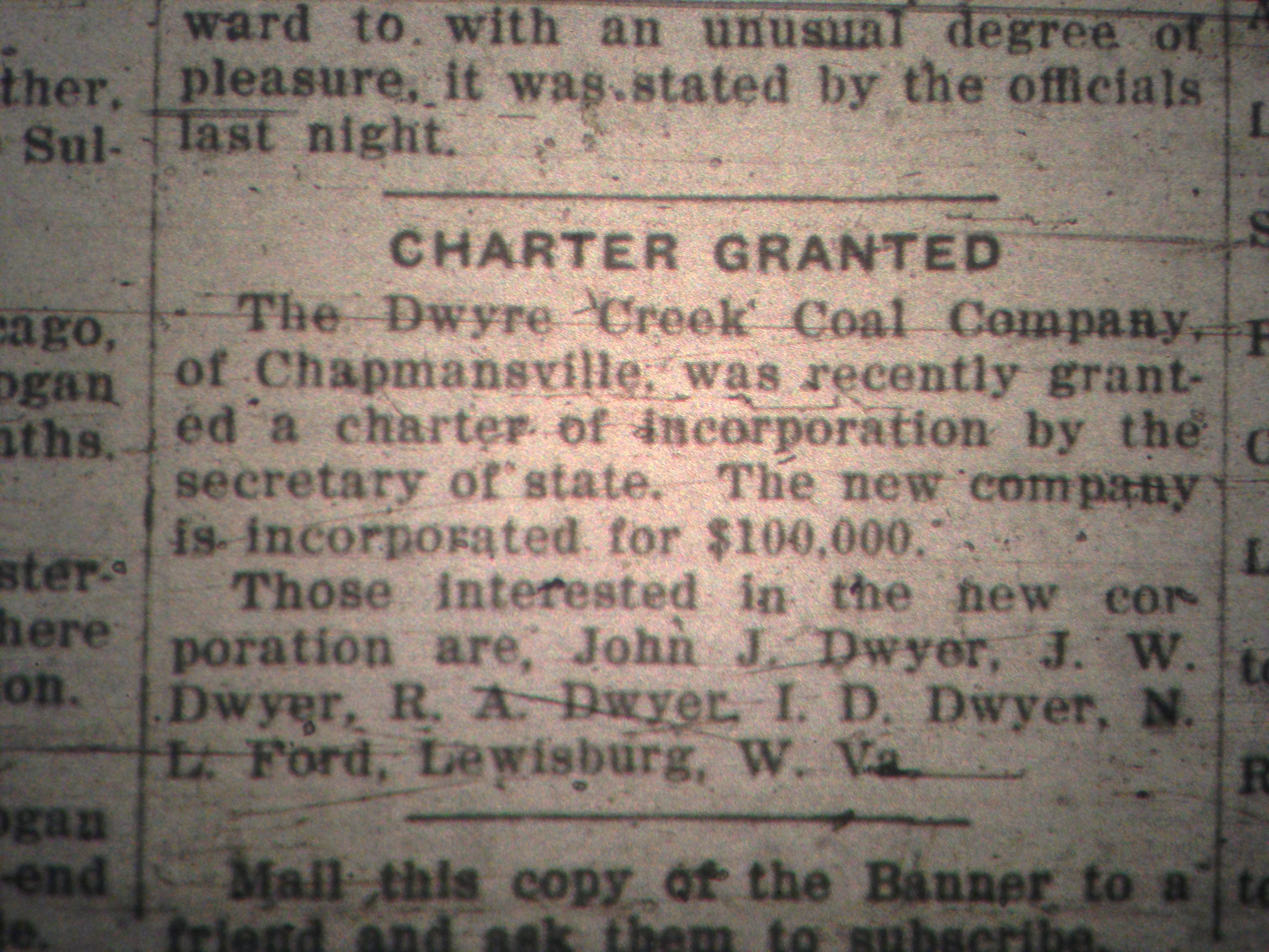
Appalachia, Chapmanville, coal, Dwyer Creek Coal Company, history, I.D. Dwyer, J.W. Dwyer, John J. Dwyer, Lewisburg, Logan County, M.L. Ford, R.A. Dwyer, West Virginia
12 Friday Feb 2021
Posted in Big Sandy Valley, Hatfield-McCoy Feud, Matewan
Tags
A.E. Steel, Anna Hatfield, Appalachia, Beech Creek, Big Sandy River, Charles R. Mounts, Conley Bottom, Conleys Creek, Daniel Christian, Dempsey Branch, Devil Anse Hatfield, Double Camp, Double Camp Branch, E.S. Murphy, Ephraim Hatfield, Floyd Hatfield, genealogy, George Hatfield, Grapevine Creek, Harrison Steel, history, Island Creek, J.D. Sergeant, Jacob Francesco, James A. Nighbert, James Ferrell, James Mounts, John Green, Johnson Hatfield, justice of the peace, L.D. Steel, Levicy Hatfield, Lewis Steel, Lick Fork, Little Kanawha Lumber Company, Logan County, Logan District, logging, Magnolia District, Magnolia Township, Mash Field, Mate Creek, Mates Creek, Meadow Branch, Mill Seat Fork, miller, Mingo County, Moses Christian, Nancy Hatfield, Philadelphia, Pigeon Creek, Plyant Mayhorn, Polly Hatfield, Preacher Anse Hatfield, Road Fork, Samuel Mayhorn, splash dams, splashing, Stuart Wood, Thacker Creek, timbering, Tug Fork, Tug River, Valentine Wall Hatfield, West Virginia, William Tiller, Wolf Pen Fork
The following land information is derived from Land Book 1866-1872, Land Book 1873-1874, Land Book 1880-1886, Land Book 1887-1892, and Land Book 1893-1899, as well as various deed books, at the Logan County Clerk’s Office in Logan, WV:
Anderson Hatfield
[Property listed in name of Levecy Hatfield in 1869, Levica Hatfield in 1870-1871, Levisa Hatfield in 1872, 1874, and 1876, Levitna Hatfield in 1873, Lavisa Hatfield in 1875, Levica Hatfield in 1889, Lovicy Hatfield in 1890-1891, Lovica Hatfield in 1892, and Levicy Hatfield in 1893.]
No property listed in land books for 1865-1867.
On October 19, 1867, George* and Nancy Hatfield of Pike County, KY, deeded 100 acres on Mate Creek to Levicy Hatfield of Logan County, WV, for five hundred dollars. The property began in the upper end of Mash Field and extended to the mouth of Meadow Branch. Witnessed by JP William Tiller on October 19, 1867.
No property listed in the land book for 1868.
1869: Magnolia Township
100 acres Mates Creek $4.20 per acre no building $420 total
55 acres Mates Creek $2.10 per acre $75 building $136.50 total
[Note: Based on the land book, both tracts were acquired in 1869 from George Hatfield of Kentucky. Also, the 55-acre total value figure did not include the value of the building. Note the actual date of purchase for one of the tracts was 1867, as per the deed.]
1870: Magnolia Township
100 acres Mates Creek $4.20 per acre no building $420 total
55 acres Mates Creek $2.10 per acre no building $136.50 total
1871-1872: Magnolia Township
100 acres Mates Creek $4.20 per acre no building $420 total
55 acres Mates Creek $2.10 per acre no building $115.50 total
[Note discrepancy in the valuation for the 55-acre tract.]
1873: Magnolia District
100 acres Mates Creek $5.25 per acre no building $441 total
55 acres Mates Creek $4.20 per acre no building $420 total
1874: Magnolia District
100 acres Mates Creek $4.20 per acre no building $420 total
55 acres Mates Creek $2.10 per acre $115.50 total
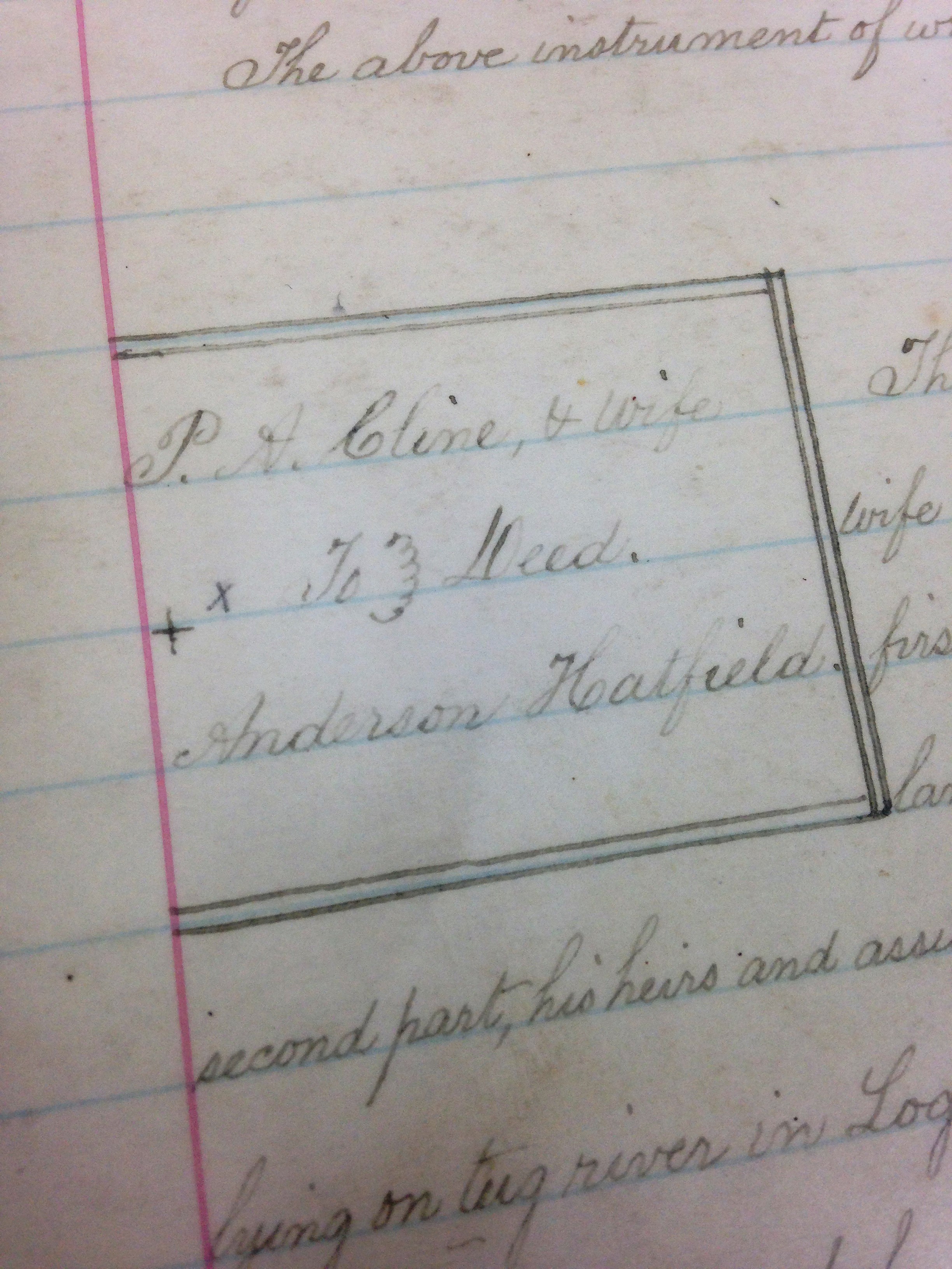
On December 29, 1874, Anderson and Lovicy Hatfield sold 200 acres to Polly Hatfield (all of Logan County) for $780 on Mates Creek. Began at the foot of the north hill at the upper end of the old Mash Field, a conditional corner between Ephraim Hatfield and Anderson Hatfield to the mouth of Meadow Branch to include all the land that George Hatfield had deeded to Lovicy Hatfield. Anderson and Lovicy signed the deed using an “x.” Justice of the peace Valentine Hatfield witnessed the deed on December 29, 1874.
[Note the original 100 acres from the 1867 deed has now become 200 acres.]
1875: Magnolia District
100 acres Mates Creek $4 per acre $50 building $400 total
55 acres Mates Creek $0.25 per acre no building $13.75 total
1876: Magnolia District
100 acres Mates Creek $4 per acre no building $400 total
55 acres Mates Creek $0.25 per acre no building $13.75
[Note: In 1876, according to the land book, Anderson Hatfield transferred 200 acres on Mates Creek worth $0.25 per acre and with a total worth of fifty dollars to Polly Hatfield; the deed is dated 1874 (see above); the 1878 land record corrected the acreage to 55 acres by order of P.A. Counts]
1877: Magnolia District
No records available for this year.
On July 2, 1877, Anderson and Lovicy Hatfield deeded 150 acres at Double Camp and Road forks of Mates Creek for $75 to Floyd Hatfield (all of Logan County). Began at the back line of the John Green survey below Double Camp, then up the main ridge to the top of the point above Road Fork, thence to John Green survey line. Anderson and Lovicy signed the deed using an “x.” Justice of the Peace Valentine Hatfield witnessed the deed on July 2, 1877.
On December 24, 1877, Anderson and Levisa Hatfield deeded 1500 acres on Grapevine Creek to James Vance, Jr. (all of Logan County) for $1400. Began near the mouth of Wolf Pen Fork, thence to the top of the mountain between Grapevine and the river, thence with mountain to dividing ridge between Grapevine and Beech Creek, thence to head of Thacker Creek, thence down ridge between Thacker and Mates Creek… References the ridge between the Wolf Pen and Mill Seat Fork. Anderson and Levicy signed the deed using an “x.” Justice Valentine Hatfield witnessed the deed on December 24, 1877.
1878: Magnolia District
Anse Hatfield owned no property in 1878.
[In 1878, as per the land book, Anderson Hatfield transferred 150 acres on Double Camp and Road Fork of Mate to Floyd Hatfield worth twenty cents per acre and with a total worth of $20. Records showed this as “transferred from Anderson Hatfield.” Note: The deed (above) shows the transfer as 1877.]
1879: Magnolia District
No records exist for this year.
1880-1881: Magnolia District
As per land book, Anse Hatfield owned no land.
On December 9, 1880, Anderson Hatfield, Lovicy Hatfield, Elias Hatfield, and Henry Mitchell deeded 200 acres on Wolf Pen Fork of Grapevine Creek to Robert Cox (all of Logan County) for $200. Anderson Hatfield, Lovicy Hatfield, Elias Hatfield, and Henry Mitchell signed the deed. Justice of the peace Valentine Hatfield witnessed the deed on December 10, 1880.
1882: Magnolia District
The Hatfield page is missing from the land book.
On January 28, 1882, Anderson and Vicy Hatfield deeded 200 acres at Lick Fork of Grapevine Creek to Johnson Hatfield (all of Logan County) for $250. Began at a large rock near the creek bank just above the garden field at the mouth of Lick Fork, thence running out to the center of the point above Lick Fork…to the head of Lick Fork and down the top of the ridge between Grapevine and Thacker Creek… Anderson and Vicy Hatfield signed the deed. Justice Valentine Hatfield witnessed the deed on January 28, 1882.
1883: Magnolia District
Records for this district are blank.
1884: Magnolia District
37 acres Tug River $1 per acre no building $37 total
2900 acres Grape Vine, Tug River $1.25 per acre $50 building $3625 total
[Note: In 1884, Anse transferred 100 acres to Daniel Christian on Grape Vine and Sandy River worth $1.25 per acre with no building and valued at $125. In 1884, Anse transferred 150 acres on Beech Creek and Sandy River to Jacob Francesco worth $1 per acre with no buildings and total value at $150. This latter tract states “by A. Hatfield by P. Mayhorn” and adds that “books don’t show A. Hatfield is owner.” Anse is not named in the 1884 deed to Jacob Francesco.]
1885: Magnolia District
37 acres Tug River $1 per acre no building $37 total
2750 acres Grapevine Creek and Tug River $1.25 per acre $50 building $3437.50 total
[In 1885, he transferred 50 acres on Sandy River to Moses Christian worth $1.25 per acre with a total worth of $62.50. In 1885, he transferred 100 acres on Grapevine Creek to Samuel Mayhorn worth $1.25 per acre with a total worth of $125.]
1886: Magnolia District
No property listed for him in 1886.
[In 1886, he transferred 500 acres on Pigeon Creek to James Ferrell worth $1.12 per acre with a total worth of $500. This note referenced him as “A. Hatfield Sr.” In 1886, he transferred 25 acres on Tug River to E.S. Murphy worth $1 per acre and a total worth of $25. In 1886, he transferred 340 acres on Beech Creek to Harrison Steel valued at $2.25 per acre and with a total worth of $765. This latter note stated: “2 years back tax and with interest; transferred from Ans Hatfield.”]
1887: Magnolia District
37 acres Tug River $1 per acre no building $37 total
2360 acres Grape Vine $1.25 per acre $50 building $2950 total
[Note: For both entries, the record reads: “one yr bk tax & interest.” In 1887, he transferred 69 acres on Sandy River worth $1 per acre and total worth of $69 to James Mounts. In 1887, he transferred with others 100 acres on Sandy River worth $1 per acre and total value of $100 to Charles R. Mounts. In 1887, he transferred 200 acres on Beech Creek to Harrison Steel worth $1 per acre and total value of $200.]
1888: Logan District
[On April 10, 1888, Lewis S. Steel sold 200 acres on Island Creek to Vicie Hatfield for $900. Deed Book L, p. 53.]
[On May 1, 1888, Anse and Levicy Hatfield agreed to a quit claim deed for mineral rights to 600 acres in the head of Island Creek to Stuart Wood for $1, and fifty cents per acre once surveyed and the title perfected. Deed Book K, p. 158-159.]
[On May 10, 1888, L.D. and A.E. Steel sold 250 acres on Island Creek to Levicy Hatfield for $500. Deed Book L, p. 52.]
1888: Magnolia District
No property listed for him, but a note in 1893 lists back taxes owed for:
Anderson Hatfield
2656 1/2 acres Grapevine Creek $3.50 per acre no building $9297.75 total
[Note: In 1888, he transferred 300 acres on Grapevine, Sandy River worth $1.25 per acre and total value of $375 to J.D. Sergeant of Philadelphia, PA. In 1888, he transferred along with others 1385 acres on Sandy River worth $1.25 per acre and total worth of $1632 to J.D. Sergeant.]
1889: Logan District
Levica Hatfield
250 acres Island Creek $1 per acre no building $250 total
200 acres Island Creek $1.40 per acre no building $280 total
1889: Magnolia District
Anderson Hatfield
2656 1/2 acres Grapevine Creek $3.50 per acre no building $9297.75 total
[On April 9, 1889, Anse and Levisy Hatfield deed to James E. Price, trustee, for $825 the mineral rights of 821 acres on Island Creek. Deed Book 47, p. 67-70.]
[On September 6, 1889, Anse Hatfield deeded all of the timber on his Island Creek property to the Little Kanawha Lumber Company for $352. References Anse having the right to put in a grist mill at the splash dam. Deed Book O, p. 410-411.]
1890-1891: Logan District
Lovicy Hatfield
250 acres Island Creek $1 per acre no building $250 total
200 acres Island Creek $1.40 per acre no building $280 total
[On November 21, 1891, Anse and Levicy Hatfield deeded to Stuart Wood and J.A. Nighbert for one dollar a right of way for splashing timber at the 821 acres. References Conley Bottom, the mouth of Dempsey Branch, and Conley’s Creek. Deed Book M, p. 189.]
1890-1891: Magnolia District
Anderson Hatfield
2656 1/2 acres Grapevine Creek $3.50 per acre no building $9297.75 total
1892: Logan District
Lovica Hatfield
250 acres Island Creek $2 per acre no building $500 total
200 acres Island Creek $5 per acre $500 building $1000 total
[On June 18, 1892, Anse and Levicy deeded to G.R. Buskirk for $2 his timber on 400 acres. Deed Book Q, p. 370.]
1892: Magnolia District
Anderson Hatfield
2656 1/2 acres Grapevine Creek $3.50 per acre no building $9297.75 total
1893-1894: Logan District
Levicy Hatfield
250 acres Island Creek $2 per acre no building $500 total
200 acres Island creek $5 per acre $500 building $1000 total
1893: Magnolia District
Anderson Hatfield
2656 1/2 acres Grapevine Creek $3.50 per acre no building $9297.75 total
[Note: In 1893, the tract at Grapevine Creek was noted: “entered with 5 yrs back taxes and interest.”]
1894: Magnolia District
Anderson Hatfield
2656 1/2 acres Grapevine Creek $3.50 per acre no building $9298 total
*George Hatfield (1804-1883), son of Ephraim and Anna (Musick) Hatfield; father of “Preacher Anse” Hatfield.
NOTE: Many discrepancies exist between the land books and deeds for Anderson Hatfield.
12 Friday Feb 2021
Posted in Big Sandy Valley, Hatfield-McCoy Feud
Tags
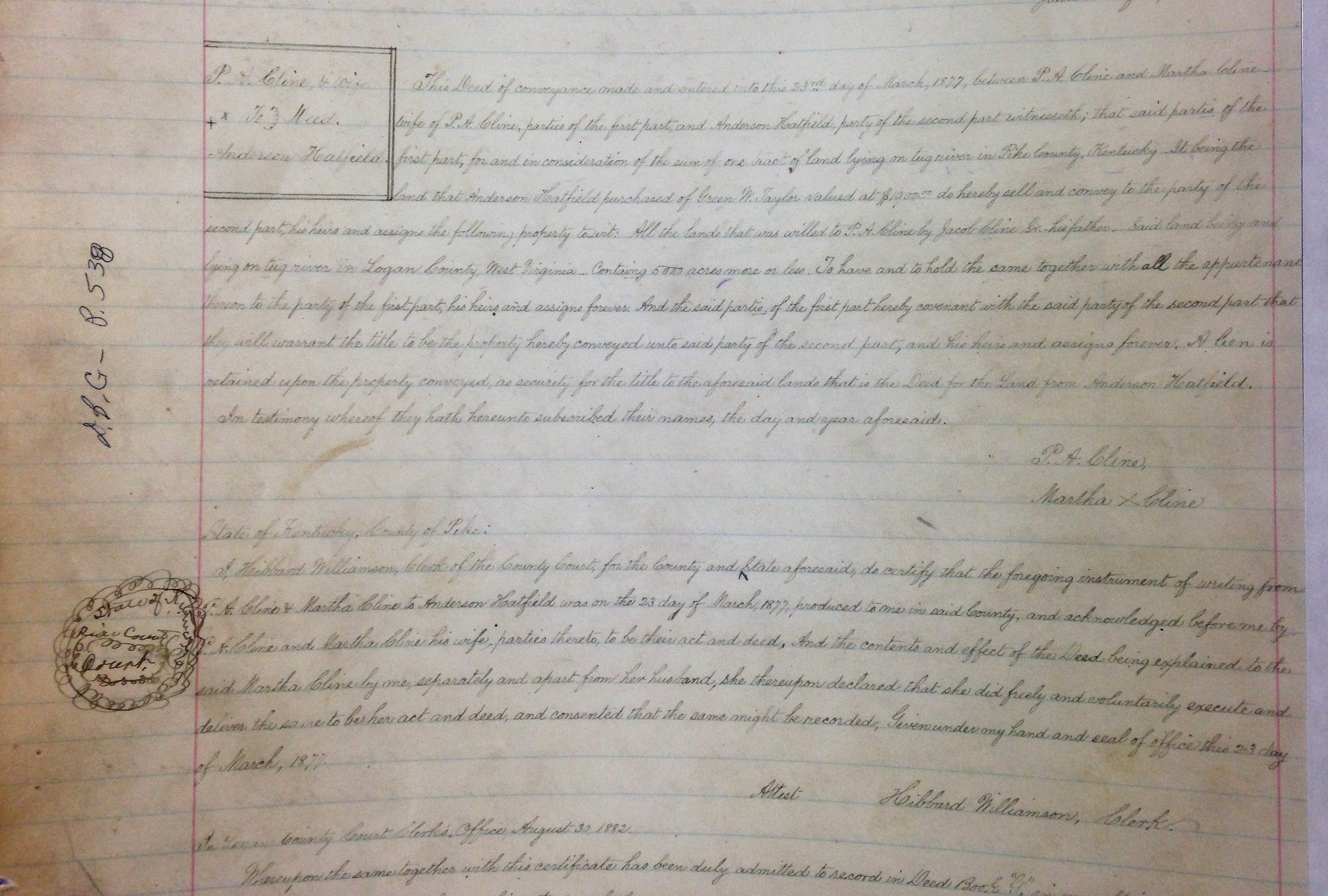
Devil Anse Hatfield, genealogy, Green W. Taylor, Hatfield-McCoy Feud, history, Jacob Cline Sr., Kentucky, Logan County, Martha Cline, Perry Cline, Pike County, Tug River, West Virginia
11 Thursday Feb 2021
Posted in Big Sandy Valley, Hatfield-McCoy Feud, Matewan
Tags
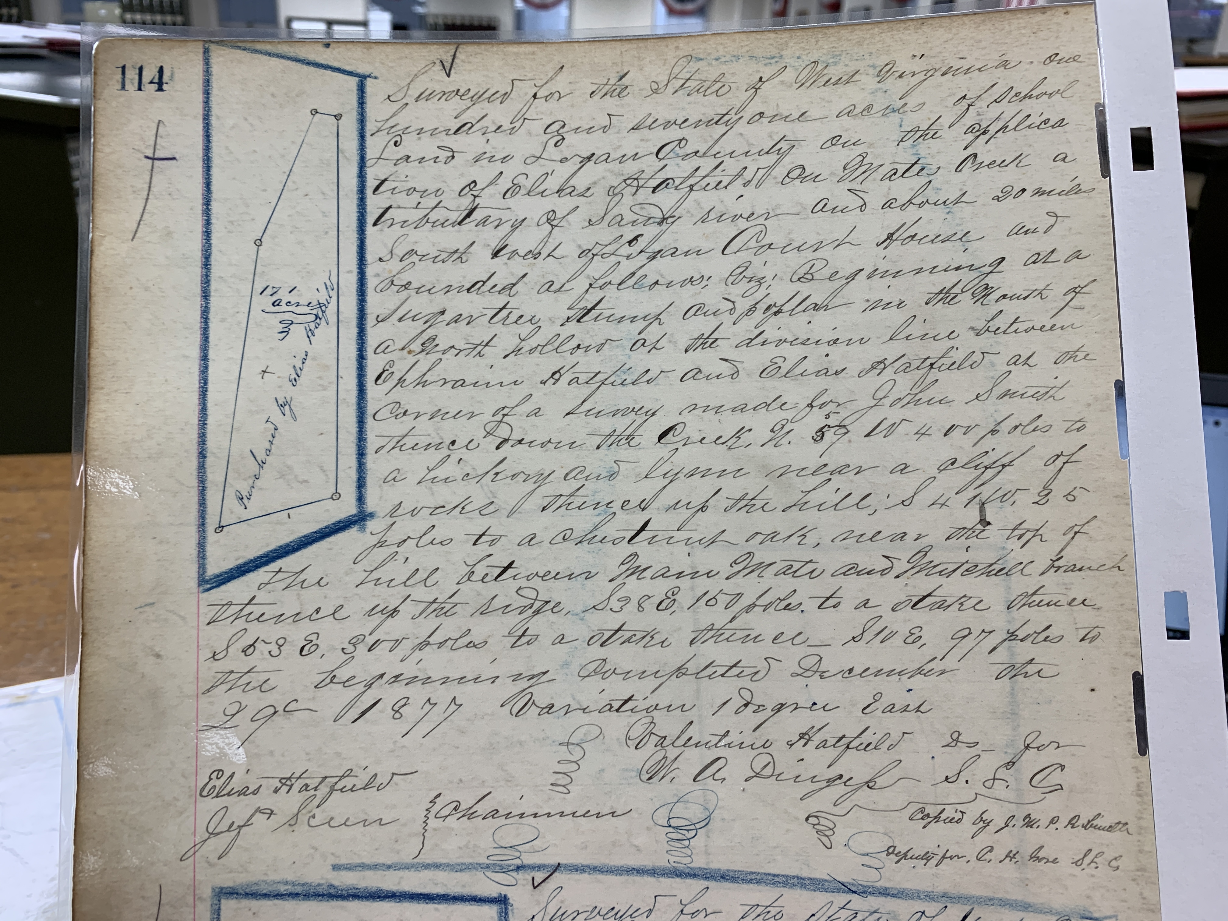
Appalachia, Big Sandy River, Elias Hatfield, Ephraim Hatfield, Hatfield-McCoy Feud, history, John Smith, Logan County, Mates Creek, Mingo County, Mitchell Branch, Valentine Wall Hatfield, W.A. Dingess, West Virginia
Writings from my travels and experiences. High and fine literature is wine, and mine is only water; but everybody likes water. Mark Twain
This site is dedicated to the collection, preservation, and promotion of history and culture in Appalachia.
Genealogy and History in North Carolina and Beyond
A site about one of the most beautiful, interesting, tallented, outrageous and colorful personalities of the 20th Century
