• About

Brandon Ray Kirk

~ This site is dedicated to the collection, preservation, and promotion of history and culture in my section of Appalachia.

Brandon Ray Kirk

Tag Archives: Ephraim Hatfield

Magnolia District: Justices of the Peace (1824-1895)

21 Thursday Apr 2022

Posted by Brandon Ray Kirk in Hatfield-McCoy Feud, Matewan

≈ Leave a comment

Tags

A.W. Ferrell, Asa McCoy, David Mounts, Ephraim Hatfield, genealogy, Hatfield-McCoy Feud, history, John Ferrell, Joseph Simpkins, justice of the peace, Logan County, Magnolia District, Michael A. Ferrell, Mingo County, Samuel F. Varney, Wall Hatfield, West Virginia, William Tiller

The following list of justices of the peace for Magnolia District in present-day Mingo County, West Virginia, is based on historical documents available at the Logan County Courthouse in Logan. Several things to consider: (1) The list will be expanded over time based on new research; (2) the targeted area for this research is the Hatfield-McCoy feud region; (3) some justices included in this list may have in fact been located outside of the feud region; (4) dates for justices are primarily derived from deeds and county court/commissioner records; and (5) Mingo County was formed from Logan County in 1895.

John Ferrell (1838)

April 26, 1838

David Mounts (1838-1840)

April 26, 1838

January 31, 1840

March 23, 1840

August 22, 1840

Samuel F. Varney (1861)

March 14, 1861

Ephraim Hatfield (1861)

March 14, 1861

William Tiller (1867)

October 1867

Valentine “Wall” Hatfield (1870-1885)

February 11, 1873

April 8-9, 1873

August 12-16, 1873

February 10-12, 1874

October 13-14, 1874

December 8-12, 1874

December 29, 1874

August 10, 1875

October 12-16, 1875

August 8-9, 1876

elected October 10, 1876

July 1, 1878

October 1879

July 1880

December 10, 1880

December 14, 1880

appointed June 13, 1881

January 28, 1882

July 22, 1885

Asa McCoy (1873-1876)

February 11-12, 1873

August 12-16, 1873

December 9-12, 1873

June 16, 1874

October 22, 1874

December 9, 1874

February 11, 1875

June 9, 1875

June 13-17, 1876

August 8-9, 1876

Ephraim Hatfield (1876-1878)

elected October 10, 1876

February 11, 1878

A.W. Ferrell (1880)

April 1880

referenced on February 8, 1881 as a former justice

Joseph Simpkins (1882)

appointed to fill unexpired term, October 17, 1882

Michael A. Ferrell (1888)

elected November 6, 1888

Asa McCoy Property in Magnolia District (1859, 1866-1886)

12 Wednesday May 2021

Posted by Brandon Ray Kirk in Big Sandy Valley, Matewan

≈ Leave a comment

Tags

Alafair Davis, Albert G. McCoy, Appalachia, Asa McCoy, Ephraim Hatfield, genealogy, H.S. Davis, history, Jane Ferrell, John Ferrell, justice of the peace, Logan County, Magnolia District, Magnolia Township, Nellie McCoy, Pigeon Creek, Thacker Fork, Tug Fork, West Virginia, William Tiller

The following land information is derived from Land Book 1866-1872, Land Book 1873-1874, Land Book 1880-1886, and Land Book 1887-1892 at the Logan County Clerk’s Office in Logan, WV:

Asa McCoy (of Logan County)1

[On June 4, 1859, Asa McCoy deeded __ acres on Pigeon Creek to John Ferrell for $__. Deed Book __, page 54. Only part of this deed is recorded. Ephraim Hatfield2 and William Tiller were justices of the peace.]

No property listed in 1865.

1866: Magnolia Township

290 acres South Side Pigeon and Thacker Fork $0.50 per acre no building $145 total

820 acres North Side Pigeon $0.50 per acre no building $410 total

No property listed for 1867-1870.

[On February 29, 1869, John and Jane Ferrell deeded 500 acres on Tug Fork of Sandy River and Sulphur Creek to Asa McCoy for $900. References the store house on the bank of the river, near the mouth of Mates Creek. William Tiller was justice of the peace. Deed Book __, page 208-209.]

1871-1874: Magnolia District

500 acres Sulphur and Sandy River $2 per acre no building $1000 total

1875-1876: Magnolia District

500 acres Sandy River and Sulphur $1.75 per acre $100 building $875 total

[On August 19, 1876, Asa and Nelly McCoy deeded 100 acres between Sulphur Creek and Tug River to Alafair Davis3 (wife of H.S. Davis) for $200. Deed Book __, page __.]

1877: Magnolia District

No records for this year for Magnolia District

1878: Magnolia District

[On February 11, 1878, Asa and Nellie McCoy deeded 150 acres to William McCoy for $500. References the mouth of Mate Creek and the land occupied by William McCoy. Ephraim Hatfield7 was justice of the peace. Deed Book __, page 484-485.]

350 acres Sandy River and Sulphur $1.75 per acre $100 building $612.50 total

1879: Magnolia District

No records for this year for Magnolia District

[On April 15, 1880, Asa and Nellie McCoy deeded 75 acres to A.G. McCoy for $200. References the first hollow below the forks of Sulphur Creek. A.W. Ferrell was a justice of the peace. Deed Book __, page 189-190.]

[On April 15, 1880, Asa and Nellie McCoy deeded 50 acres to Albert G. McCoy for $50. References the first hollow on the right hand side of Sulphur. Deed Book __, page __.]

1880: Magnolia District

350 acres Sandy River and Sulphur $1.75 per acre $100 building $612.50 total

1881: Magnolia District

225 acres Sandy River $1.75 per acre no building $262.50 total

1882: Magnolia District

Pages missing.

1883: Magnolia District

125 acres Sulphur Branch Sandy River $2 per acre [rest blank]

1884-1885: Magnolia District

125 acres Sulpher Branch and Sandy River $2 per acre $75 building $250 total

1886: Magnolia District

125 acres Sulphur of Sandy $2 per acre $75 building $75 total

1887: Magnolia District

125 acres Sulphurr of Sandy River $2 per acre $75 building $250 total

***

1Brother to Sallie (McCoy) McCoy.

2Most likely, this is the father to Devil Anse Hatfield.

3Daughter of Asa and Nelly McCoy

Valentine Hatfield, Jr. Survey (1858)

11 Tuesday May 2021

Posted by Brandon Ray Kirk in Big Sandy Valley, Matewan

≈ Leave a comment

Tags

Anderson Hatfield, Appalachia, Ephraim Hatfield, Evermont Ward, genealogy, history, James Lawson, John Allen, Logan County, Mates Creek, Mingo County, Valentine Hatfield, Virginia, West Virginia, William A. Dempsey

Surveyors Record Book B, p. ____, Logan County Clerk’s Office, Logan, WV.

E. Hatfield Survey (1878)

01 Thursday Apr 2021

Posted by Brandon Ray Kirk in Big Sandy Valley, Matewan

≈ Leave a comment

Tags

Appalachia, Big Sandy River, C.H. Gore, Double Camp Fork, Ephraim Hatfield, Floyd Hatfield, genealogy, history, John Gore, John Lee Buskirk, Logan County, Mate Creek, Mingo County, sheriff, surveyor, Valentine Hatfield, West Virginia, William Anderson Dingess

E. Hatfield survey, 95 1/2 acres, Mate Creek (1878), Surveyors Record Book B, page __, Logan County Clerk’s Office, Logan, WV. Note: This property is located in present-day Mingo County.

Ellison Hatfield Property in Logan County, WV (1880-1893)

16 Tuesday Feb 2021

Posted by Brandon Ray Kirk in Big Sandy Valley, Hatfield-McCoy Feud, Matewan

≈ Leave a comment

Tags

Appalachia, Double Camp Branch, Ellison Hatfield, Ephraim Hatfield, genealogy, H.R. Phillips, Hatfield-McCoy Feud, history, Logan County, Magnolia District, Mates Creek, Mingo County, West Virginia

The following land information is derived from Land Book 1880-1886, Land Book 1887-1892, and Land Book 1893-1899 at the Logan County Clerk’s Office in Logan, WV:

Ellison Hatfield

No property listed in 1865-1879.

1880: Magnolia District

50 acres Double Camp Fork, Ben Creek $0.25 per acre no building $12.50

300 acres Mates Creek $0.25 per acre no building $75 total

[Note: The 300-acre tract was transferred from Ephraim Hatfield.]

1881: Magnolia District

50 acres Double Camp Fork Mates Creek $0.25 per acre no building $12 total

276 acres Mates Creek $0.25 per acre no building $69 total

[Note: The reduction of the 300-acre tract is unexplained.]

1882: Magnolia District

The Hatfield page is missing.

1883: Magnolia District

No records are listed for this year.

1884: Magnolia District

50 acres Double Camp Br. Mates Creek $2.50 per acre $25 building $125 total

276 acres Double Camp Br. Mates Creek $1 per acre no building $276 total

20 acres Double Camp Mates Creek $1 per acre no building $20 total

[Note: The 50-acre and 276-acre tract is listed in the name of “Ellison Hatfield’s Heirs”. The 20-acre tract is listed in the name of Ellison Hatfield.]

1885: Magnolia District

50 acres Double Camp Branch, Mates Creek $2.50 per acre $25 building $125 total

276 acres Double Camp Branch, Mates Creek $1 per acre no building $276 total

50 acres Double Camp Branch, Mates Creek $2.50 per acre $30 building $125 total

1886: Magnolia District

50 acres Mates Creek $2.50 per acre no building $56 total

20 acres Mates Creek $1 per acre no building $130 total

1887-1889: Magnolia District

Ellison Hatfield

50 acres Mates Creek $2.50 per acre $30 building $125 total

20 acres Mates Creek $1 per acre no building $20 total

Ellison Hatfield’s Heirs

50 acres Double Camp, Mates Creek $2.50 per acre $25 building $125 total

276 acres Double Camp, Mates Creek $1 per acre no building $276 total

20 acres Double Camp, Mates Creek $1 per acre no building $20 total

[Note: In 1887, the latter three tracts are noted as “one yr back tax & interest.” In 1888, the latter three tracts are noted as “sold to Okeefe for tax.” In 1889, the latter three tracts are restored to Ellison Hatfield’s heirs.]

1890-1891: Magnolia District

Ellison Hatfield

50 acres Mates Creek $2.50 per acre $30 building $125 total

20 acres Mates Creek $1 per acre no building $20 total

Ellison Hatfield’s Heirs

50 acres Double Camp, Mates Creek $2.50 per acre $25 building $125 total

276 acres Double Camp, Mates Creek $1 per acre no building $276 total

28 acres Double Camp, Mates Creek $1 per acre no building $28 total

1892: Magnolia District

Ellison Hatfield

50 acres Mates Creek $2.50 per acre $25 building $125 total

20 acres Mates Creek $2 per acre $40 building $175 total

Ellison Hatfield’s Heirs

50 acres Double Camp, Mates Creek $3.50 per acre $30 building $175 total

276 acres Double Camp, Mates Creek $3.50 per acre no building $966 total

28 acres Double Camp, Mates Creek $3.50 per acre no building $98 total

1893: Magnolia District

Ellison Hatfield

50 acres Mates Creek $2.50 per acre $30 building $125 total

20 acres Mates Creek $2 per acre no building $40 total

[In 1893, Ellison Hatfield’s heirs by commissioner transferred 250 acres on Mates Creek worth $3.50 per acre and total value of $875 to H.R. Phillips, trustee.]

Smith and Patterson Hatfield Property in Logan County, WV (1878-1894)

15 Monday Feb 2021

Posted by Brandon Ray Kirk in Big Sandy Valley, Hatfield-McCoy Feud, Matewan

≈ Leave a comment

Tags

Appalachia, Ephraim Hatfield, genealogy, Hatfield-McCoy Feud, history, Logan County, Magnolia District, Marks Branch, Mates Creek, Mingo County, Nancy Hatfield, Patterson Hatfield, Smith Hatfield, West Virginia

The following land information is derived from Land Book 1873-1874, Land Book 1880-1886, and Land Book 1893-1899 at the Logan County Clerk’s Office in Logan, WV:

Smith and Patterson Hatfield

No property listed in 1865-1877.

1878: Magnolia District

Smith and Patterson Hatfield

100 acres Mates Creek $4 per acre $25 building $400 total

[Note: This tract was transferred from Ephraim Hatfield in 1878.]

Smith Hatfield

25 acres Marks Branch, Mates Creek $0.20 per acre no building $5 total

1879: Magnolia District

No records for this year.

1880-1881: Magnolia District

Smith and Patterson Hatfield

100 acres Mates Creek $4 per acre $25 building $400 total

Smith Hatfield

25 acres Marks Branch, Mates Creek $0.20 per acre no building $5 total

[Note: In the 1880 census, widowed Nancy Hatfield lived with her son, Patterson.]

1882: Magnolia District

The Hatfield page is missing.

1883: Magnolia District

The page is mostly blank but does list:

Smith Hatfield 25 acres M__ Br of Mates Creek $2.50 per acre [rest is blank]

1884-1885: Magnolia District

Smith and Patterson Hatfield

100 acres Mates Creek $3 per acre $35 building $300 total

Smith Hatfield

25 acres Marks Br. of Mates Creek $2.50 per acre no building $62.50 total

1886: Magnolia District

Smith and Patterson Hatfield

100 acres Mates Creek $3 per acre no building $230 total

Smith Hatfield

25 acres Mack Branch, Mates Creek $2.50 per acre [blank]

1887-1888: Magnolia District

Smith and Patterson Hatfield

100 acres Mates Creek $3 per acre $35 building $300 total

Smith Hatfield

25 acres Marks Branch, Mates Creek $2.50 per acre no building $62.50 total

1889: Magnolia District

Smith Hatfield

25 acres Mark Branch, Mate Creek $2.50 per acre no building $65 total

Pat Hatfield

50 acres Mates Creek $3 per acre $35 building $150 total

1890: Magnolia District

Smith Hatfield

25 acres Mate Creek $2.50 per acre no building $65 total

50 acres Mate Creek $3 per acre $35 building $150 total

Patterson Hatfield

50 acres Mate Creek $3 per acre $30 building $150 total

1891-1892: Magnolia District

Smith Hatfield

25 acres Mate Creek $2.50 per acre no building $62.50 total

50 acres Mate Creek $3 per acre $35 building $150 total

Patterson Hatfield

50 acres Mate Creek $3 per acre $30 building $150 total

1893-1894: Magnolia District

Smith Hatfield

25 acres Mate Creek $2.50 per acre no building $62.50 total

50 acres Mate Creek $3 per acre $40 building $150 total

Patterson Hatfield

50 acres Mate Creek $2.50 per acre $40 building $125 total

Valentine “Wall” Hatfield Property in Logan County (1874-1893)

13 Saturday Feb 2021

Posted by Brandon Ray Kirk in Big Sandy Valley, Hatfield-McCoy Feud

≈ 1 Comment

Tags

Appalachia, Beech Creek, Big Sandy River, Doc Mahon, Double Camp Branch, Ephraim Hatfield, genealogy, Hatfield-McCoy Feud, history, J.D. Sergeant, Jane Hatfield, Logan County, Magnolia District, Mingo County, Philadelphia, Valentine Wall Hatfield, West Virginia

The following land information is derived from Land Book 1873-1874, Land Book 1880-1886, Land Book 1887-1892, and Land Book 1893-1899 at the Logan County Clerk’s Office in Logan, WV:

Valentine Hatfield

No property listed in 1865-1873.

1874: Magnolia District

84 acres Beech Creek, Sandy River $5.25 per acre no building $441 total

144 acres Double Camp Branch, Beech $0.10 per acre no building $14.40 total

[Note: Regarding the latter tract, the book reads “entered on Books and corrected.”]

1875: Magnolia District

84 acres Beech Creek, Sandy River $5.25 per acre no building $441 total

144 acres Double Camp Branch, Beech $0.25 per acre no building $36 total

1876: Magnolia District

84 acres Beech Creek, Sandy River $5.25 per acre no building $441 total

144 acres Double Camp Branch, Beech $0.10 per acre no building $14.40 total

1877: Magnolia District

The record is blank.

1878: Magnolia District

48 acres Beech Creek $5.25 per acre no building $141 total

144 acres Double Camp Branch, Beech Creek $0.25 per acre no building $36 total

1879: Magnolia District

No records for this year.

1880-1881: Magnolia District

84 acres Beech Creek $5.25 per acre no building $441 total

144 acres Double Camp and Mates Creek $0.25 per acre no building $36 total

1882: Magnolia District

The Hatfield page is missing

1883: Magnolia District

The record is blank for this year.

1884-1885: Magnolia District

84 acres Beech Creek, Sandy River $5 per acre $50 building $420 total

144 acres Double Camp, Sandy River $1 per acre no building $144 total

1886: Magnolia District

84 acres Beech Creek, Sandy River $5 per acre $15 building $125 total

114 acres Double Camp, Sandy River $1 per acre $75 building $280 total

1887: Magnolia District

84 acres Beech Creek $5 per acre $50 building $420 total

144 acres Double Camp, Mates Creek $1 per acre no building $144 total

1888: Magnolia District

44 acres Beech Creek $5 per acre $50 building $220 total

144 acres Beech Creek $1 per acre no building $144 total

[Note: In this year, Wall Hatfield transferred 40 acres of the 84-acre tract to Doc Mahon.]

1889: Magnolia District

No property listed.

[In 1889, he transferred 89 acres on Beech Creek worth $1 per acre and total value of $89 to Ephraim Hatfield. Also, transferred with others 126 acres on Beech Creek worth $1 per acre and total value of $126 to J.D. Sergeant of Philadelphia.]

1890: Magnolia District

No property listed.

[Note: Wall Hatfield died on February 13, 1890 at Frankfort, KY.]

1891: Magnolia District

Jane Hatfield

84 acres, Beech Creek, $2 per acre, no building, $168 total

[Note: “Entered with 1 yr B tax.”]

1892-1893: Magnolia District

Jane Hatfield

84 acres, Beech Creek, $2.50 per acre, $40 building, $210 total

Anderson Hatfield Property in Logan County (1869-1893)

12 Friday Feb 2021

Posted by Brandon Ray Kirk in Big Sandy Valley, Hatfield-McCoy Feud, Matewan

≈ Leave a comment

Tags

A.E. Steel, Anna Hatfield, Appalachia, Beech Creek, Big Sandy River, Charles R. Mounts, Conley Bottom, Conleys Creek, Daniel Christian, Dempsey Branch, Devil Anse Hatfield, Double Camp, Double Camp Branch, E.S. Murphy, Ephraim Hatfield, Floyd Hatfield, genealogy, George Hatfield, Grapevine Creek, Harrison Steel, history, Island Creek, J.D. Sergeant, Jacob Francesco, James A. Nighbert, James Ferrell, James Mounts, John Green, Johnson Hatfield, justice of the peace, L.D. Steel, Levicy Hatfield, Lewis Steel, Lick Fork, Little Kanawha Lumber Company, Logan County, Logan District, logging, Magnolia District, Magnolia Township, Mash Field, Mate Creek, Mates Creek, Meadow Branch, Mill Seat Fork, miller, Mingo County, Moses Christian, Nancy Hatfield, Philadelphia, Pigeon Creek, Plyant Mayhorn, Polly Hatfield, Preacher Anse Hatfield, Road Fork, Samuel Mayhorn, splash dams, splashing, Stuart Wood, Thacker Creek, timbering, Tug Fork, Tug River, Valentine Wall Hatfield, West Virginia, William Tiller, Wolf Pen Fork

The following land information is derived from Land Book 1866-1872, Land Book 1873-1874, Land Book 1880-1886, Land Book 1887-1892, and Land Book 1893-1899, as well as various deed books, at the Logan County Clerk’s Office in Logan, WV:

Anderson Hatfield

[Property listed in name of Levecy Hatfield in 1869, Levica Hatfield in 1870-1871, Levisa Hatfield in 1872, 1874, and 1876, Levitna Hatfield in 1873, Lavisa Hatfield in 1875, Levica Hatfield in 1889, Lovicy Hatfield in 1890-1891, Lovica Hatfield in 1892, and Levicy Hatfield in 1893.]

No property listed in land books for 1865-1867.

On October 19, 1867, George* and Nancy Hatfield of Pike County, KY, deeded 100 acres on Mate Creek to Levicy Hatfield of Logan County, WV, for five hundred dollars. The property began in the upper end of Mash Field and extended to the mouth of Meadow Branch. Witnessed by JP William Tiller on October 19, 1867.

No property listed in the land book for 1868.

1869: Magnolia Township

100 acres Mates Creek $4.20 per acre no building $420 total

55 acres Mates Creek $2.10 per acre $75 building $136.50 total

[Note: Based on the land book, both tracts were acquired in 1869 from George Hatfield of Kentucky. Also, the 55-acre total value figure did not include the value of the building. Note the actual date of purchase for one of the tracts was 1867, as per the deed.]

1870: Magnolia Township

100 acres Mates Creek $4.20 per acre no building $420 total

55 acres Mates Creek $2.10 per acre no building $136.50 total

1871-1872: Magnolia Township

100 acres Mates Creek $4.20 per acre no building $420 total

55 acres Mates Creek $2.10 per acre no building $115.50 total

[Note discrepancy in the valuation for the 55-acre tract.]

1873: Magnolia District

100 acres Mates Creek $5.25 per acre no building $441 total

55 acres Mates Creek $4.20 per acre no building $420 total

1874: Magnolia District

100 acres Mates Creek $4.20 per acre no building $420 total

55 acres Mates Creek $2.10 per acre $115.50 total

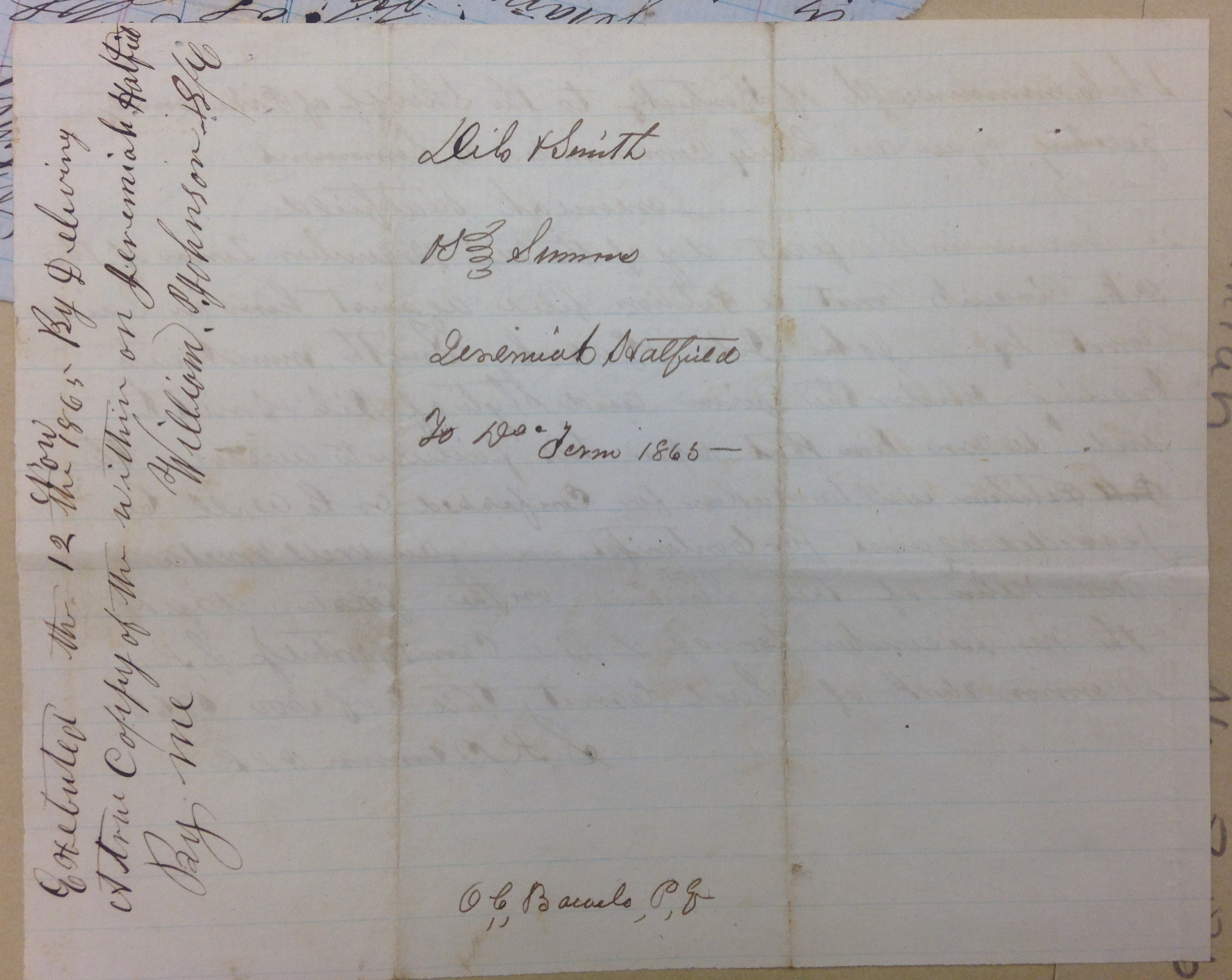
On December 29, 1874, Anderson and Lovicy Hatfield sold 200 acres to Polly Hatfield (all of Logan County) for $780 on Mates Creek. Began at the foot of the north hill at the upper end of the old Mash Field, a conditional corner between Ephraim Hatfield and Anderson Hatfield to the mouth of Meadow Branch to include all the land that George Hatfield had deeded to Lovicy Hatfield. Anderson and Lovicy signed the deed using an “x.” Justice of the peace Valentine Hatfield witnessed the deed on December 29, 1874.

[Note the original 100 acres from the 1867 deed has now become 200 acres.]

1875: Magnolia District

100 acres Mates Creek $4 per acre $50 building $400 total

55 acres Mates Creek $0.25 per acre no building $13.75 total

1876: Magnolia District

100 acres Mates Creek $4 per acre no building $400 total

55 acres Mates Creek $0.25 per acre no building $13.75

[Note: In 1876, according to the land book, Anderson Hatfield transferred 200 acres on Mates Creek worth $0.25 per acre and with a total worth of fifty dollars to Polly Hatfield; the deed is dated 1874 (see above); the 1878 land record corrected the acreage to 55 acres by order of P.A. Counts]

1877: Magnolia District

No records available for this year.

On July 2, 1877, Anderson and Lovicy Hatfield deeded 150 acres at Double Camp and Road forks of Mates Creek for $75 to Floyd Hatfield (all of Logan County). Began at the back line of the John Green survey below Double Camp, then up the main ridge to the top of the point above Road Fork, thence to John Green survey line. Anderson and Lovicy signed the deed using an “x.” Justice of the Peace Valentine Hatfield witnessed the deed on July 2, 1877.

On December 24, 1877, Anderson and Levisa Hatfield deeded 1500 acres on Grapevine Creek to James Vance, Jr. (all of Logan County) for $1400. Began near the mouth of Wolf Pen Fork, thence to the top of the mountain between Grapevine and the river, thence with mountain to dividing ridge between Grapevine and Beech Creek, thence to head of Thacker Creek, thence down ridge between Thacker and Mates Creek… References the ridge between the Wolf Pen and Mill Seat Fork. Anderson and Levicy signed the deed using an “x.” Justice Valentine Hatfield witnessed the deed on December 24, 1877.

1878: Magnolia District

Anse Hatfield owned no property in 1878.

[In 1878, as per the land book, Anderson Hatfield transferred 150 acres on Double Camp and Road Fork of Mate to Floyd Hatfield worth twenty cents per acre and with a total worth of $20. Records showed this as “transferred from Anderson Hatfield.” Note: The deed (above) shows the transfer as 1877.]

1879: Magnolia District

No records exist for this year.

1880-1881: Magnolia District

As per land book, Anse Hatfield owned no land.

On December 9, 1880, Anderson Hatfield, Lovicy Hatfield, Elias Hatfield, and Henry Mitchell deeded 200 acres on Wolf Pen Fork of Grapevine Creek to Robert Cox (all of Logan County) for $200. Anderson Hatfield, Lovicy Hatfield, Elias Hatfield, and Henry Mitchell signed the deed. Justice of the peace Valentine Hatfield witnessed the deed on December 10, 1880.

1882: Magnolia District

The Hatfield page is missing from the land book.

On January 28, 1882, Anderson and Vicy Hatfield deeded 200 acres at Lick Fork of Grapevine Creek to Johnson Hatfield (all of Logan County) for $250. Began at a large rock near the creek bank just above the garden field at the mouth of Lick Fork, thence running out to the center of the point above Lick Fork…to the head of Lick Fork and down the top of the ridge between Grapevine and Thacker Creek… Anderson and Vicy Hatfield signed the deed. Justice Valentine Hatfield witnessed the deed on January 28, 1882.

1883: Magnolia District

Records for this district are blank.

1884: Magnolia District

37 acres Tug River $1 per acre no building $37 total

2900 acres Grape Vine, Tug River $1.25 per acre $50 building $3625 total

[Note: In 1884, Anse transferred 100 acres to Daniel Christian on Grape Vine and Sandy River worth $1.25 per acre with no building and valued at $125. In 1884, Anse transferred 150 acres on Beech Creek and Sandy River to Jacob Francesco worth $1 per acre with no buildings and total value at $150. This latter tract states “by A. Hatfield by P. Mayhorn” and adds that “books don’t show A. Hatfield is owner.” Anse is not named in the 1884 deed to Jacob Francesco.]

1885: Magnolia District

37 acres Tug River $1 per acre no building $37 total

2750 acres Grapevine Creek and Tug River $1.25 per acre $50 building $3437.50 total

[In 1885, he transferred 50 acres on Sandy River to Moses Christian worth $1.25 per acre with a total worth of $62.50. In 1885, he transferred 100 acres on Grapevine Creek to Samuel Mayhorn worth $1.25 per acre with a total worth of $125.]

1886: Magnolia District

No property listed for him in 1886.

[In 1886, he transferred 500 acres on Pigeon Creek to James Ferrell worth $1.12 per acre with a total worth of $500. This note referenced him as “A. Hatfield Sr.” In 1886, he transferred 25 acres on Tug River to E.S. Murphy worth $1 per acre and a total worth of $25. In 1886, he transferred 340 acres on Beech Creek to Harrison Steel valued at $2.25 per acre and with a total worth of $765. This latter note stated: “2 years back tax and with interest; transferred from Ans Hatfield.”]

1887: Magnolia District

37 acres Tug River $1 per acre no building $37 total

2360 acres Grape Vine $1.25 per acre $50 building $2950 total

[Note: For both entries, the record reads: “one yr bk tax & interest.” In 1887, he transferred 69 acres on Sandy River worth $1 per acre and total worth of $69 to James Mounts. In 1887, he transferred with others 100 acres on Sandy River worth $1 per acre and total value of $100 to Charles R. Mounts. In 1887, he transferred 200 acres on Beech Creek to Harrison Steel worth $1 per acre and total value of $200.]

1888: Logan District

[On April 10, 1888, Lewis S. Steel sold 200 acres on Island Creek to Vicie Hatfield for $900. Deed Book L, p. 53.]

[On May 1, 1888, Anse and Levicy Hatfield agreed to a quit claim deed for mineral rights to 600 acres in the head of Island Creek to Stuart Wood for $1, and fifty cents per acre once surveyed and the title perfected. Deed Book K, p. 158-159.]

[On May 10, 1888, L.D. and A.E. Steel sold 250 acres on Island Creek to Levicy Hatfield for $500. Deed Book L, p. 52.]

1888: Magnolia District

No property listed for him, but a note in 1893 lists back taxes owed for:

Anderson Hatfield

2656 1/2 acres Grapevine Creek $3.50 per acre no building $9297.75 total

[Note: In 1888, he transferred 300 acres on Grapevine, Sandy River worth $1.25 per acre and total value of $375 to J.D. Sergeant of Philadelphia, PA. In 1888, he transferred along with others 1385 acres on Sandy River worth $1.25 per acre and total worth of $1632 to J.D. Sergeant.]

1889: Logan District

Levica Hatfield

250 acres Island Creek $1 per acre no building $250 total

200 acres Island Creek $1.40 per acre no building $280 total

1889: Magnolia District

Anderson Hatfield

2656 1/2 acres Grapevine Creek $3.50 per acre no building $9297.75 total

[On April 9, 1889, Anse and Levisy Hatfield deed to James E. Price, trustee, for $825 the mineral rights of 821 acres on Island Creek. Deed Book 47, p. 67-70.]

[On September 6, 1889, Anse Hatfield deeded all of the timber on his Island Creek property to the Little Kanawha Lumber Company for $352. References Anse having the right to put in a grist mill at the splash dam. Deed Book O, p. 410-411.]

1890-1891: Logan District

Lovicy Hatfield

250 acres Island Creek $1 per acre no building $250 total

200 acres Island Creek $1.40 per acre no building $280 total

[On November 21, 1891, Anse and Levicy Hatfield deeded to Stuart Wood and J.A. Nighbert for one dollar a right of way for splashing timber at the 821 acres. References Conley Bottom, the mouth of Dempsey Branch, and Conley’s Creek. Deed Book M, p. 189.]

1890-1891: Magnolia District

Anderson Hatfield

2656 1/2 acres Grapevine Creek $3.50 per acre no building $9297.75 total

1892: Logan District

Lovica Hatfield

250 acres Island Creek $2 per acre no building $500 total

200 acres Island Creek $5 per acre $500 building $1000 total

[On June 18, 1892, Anse and Levicy deeded to G.R. Buskirk for $2 his timber on 400 acres. Deed Book Q, p. 370.]

1892: Magnolia District

Anderson Hatfield

2656 1/2 acres Grapevine Creek $3.50 per acre no building $9297.75 total

1893-1894: Logan District

Levicy Hatfield

250 acres Island Creek $2 per acre no building $500 total

200 acres Island creek $5 per acre $500 building $1000 total

1893: Magnolia District

Anderson Hatfield

2656 1/2 acres Grapevine Creek $3.50 per acre no building $9297.75 total

[Note: In 1893, the tract at Grapevine Creek was noted: “entered with 5 yrs back taxes and interest.”]

1894: Magnolia District

Anderson Hatfield

2656 1/2 acres Grapevine Creek $3.50 per acre no building $9298 total

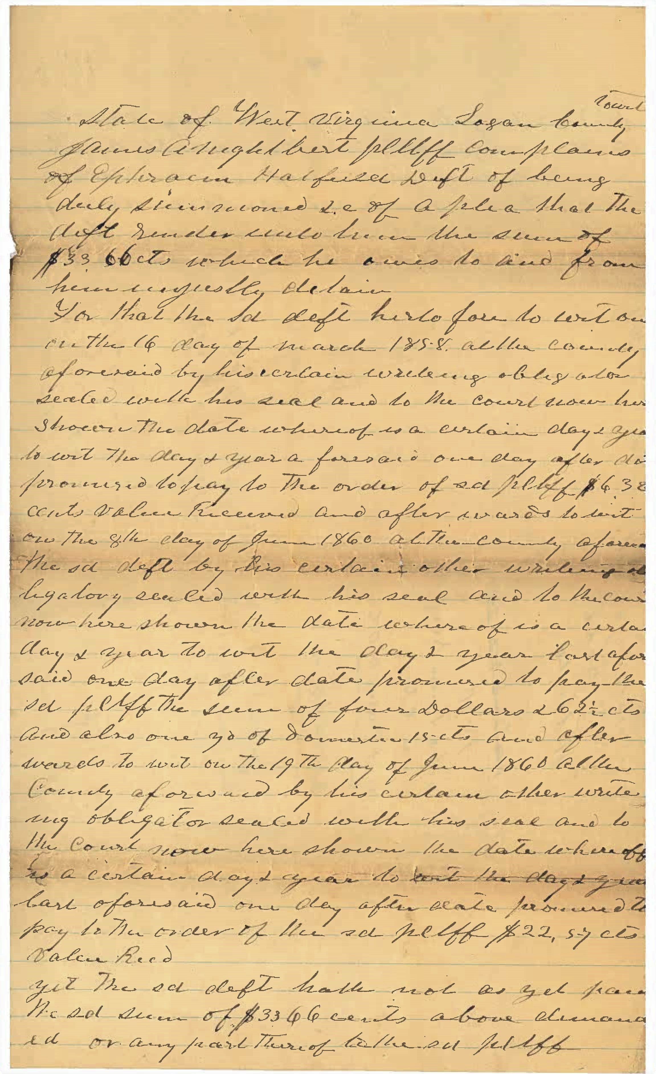
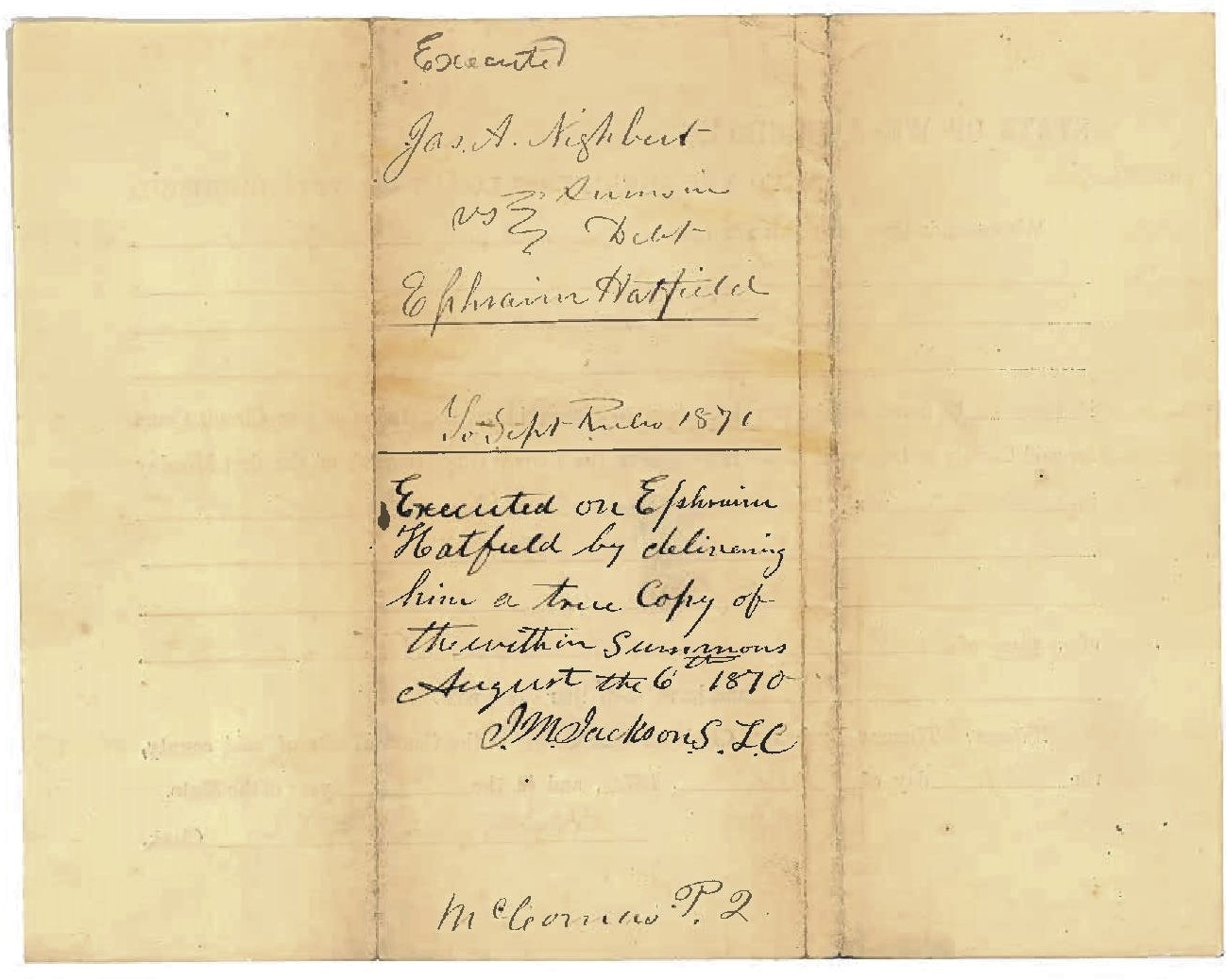
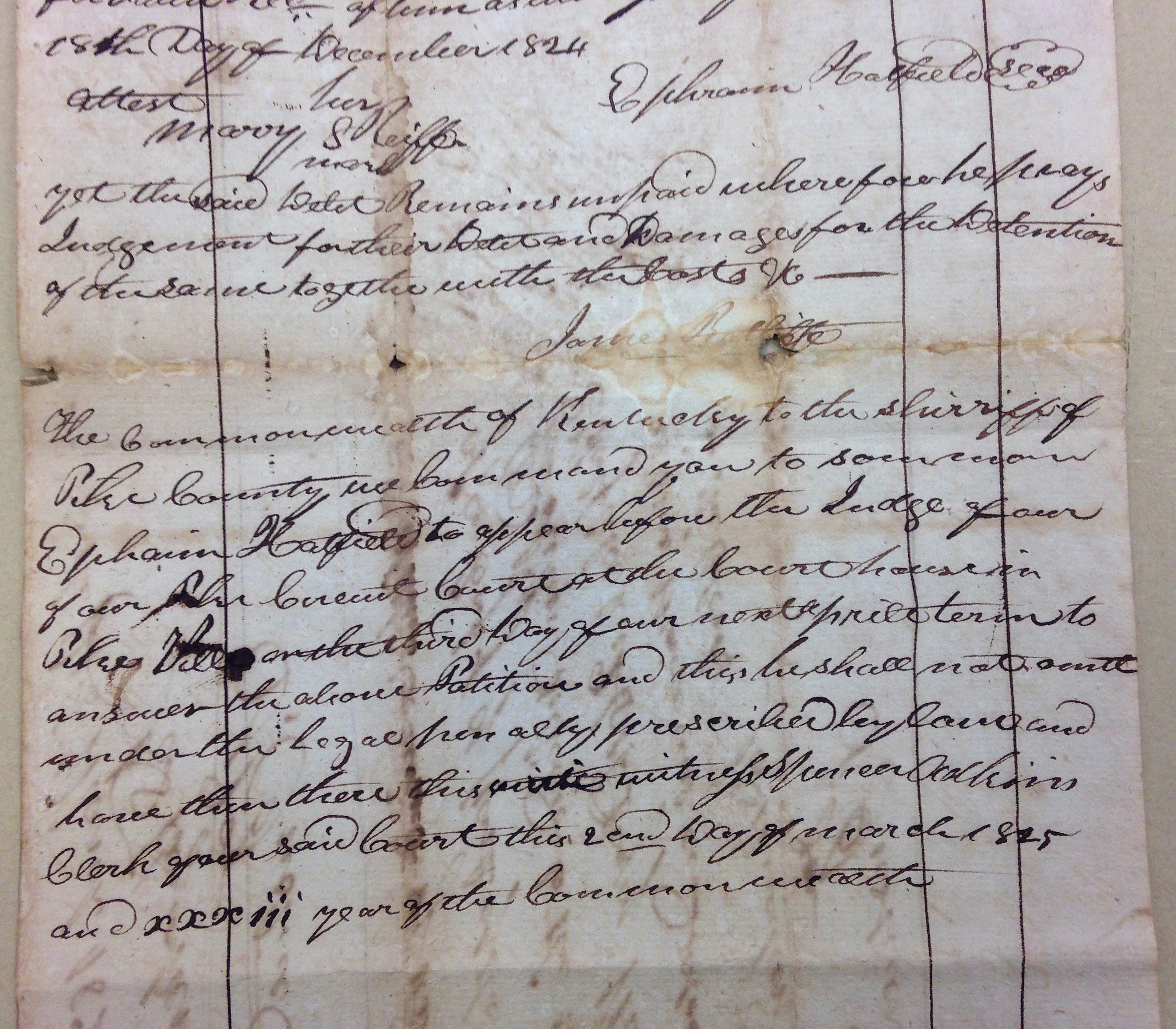
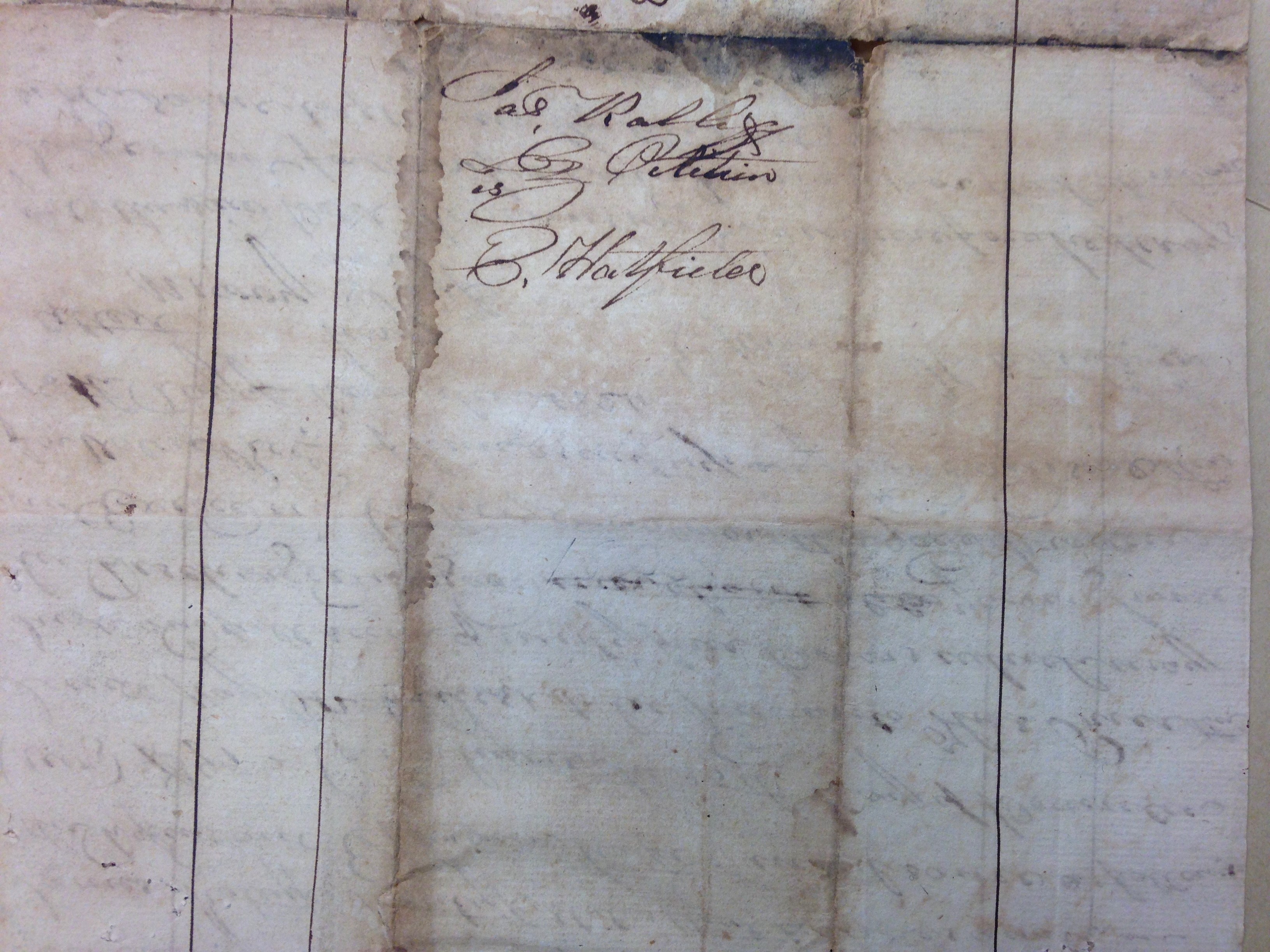
*George Hatfield (1804-1883), son of Ephraim and Anna (Musick) Hatfield; father of “Preacher Anse” Hatfield.

NOTE: Many discrepancies exist between the land books and deeds for Anderson Hatfield.

Elias Hatfield Survey (1877)

11 Thursday Feb 2021

Posted by Brandon Ray Kirk in Big Sandy Valley, Hatfield-McCoy Feud, Matewan

≈ Leave a comment

Tags

Appalachia, Big Sandy River, Elias Hatfield, Ephraim Hatfield, Hatfield-McCoy Feud, history, John Smith, Logan County, Mates Creek, Mingo County, Mitchell Branch, Valentine Wall Hatfield, W.A. Dingess, West Virginia

Elias Hatfield, 171 acres of school land, Mates Creek, Surveyors Record Book B, Logan County Clerk’s Office, Logan, WV.

Ephraim Hatfield Property in Logan County (1865-1885)

02 Tuesday Feb 2021

Posted by Brandon Ray Kirk in Big Sandy Valley, Hatfield-McCoy Feud, Matewan

≈ Leave a comment

Tags

Appalachia, Beech Creek, Big Sandy River, Double Camp Branch, Ephraim Hatfield, genealogy, Hatfield-McCoy Feud, history, Lewis Ferrell, Logan County, Magnolia District, Magnolia Township, Mates Creek, Meador Branch, Mingo County, Murphys Branch, Nancy Varney, Patterson Hatfield, Smith Hatfield, Straight Fork, Valentine Wall Hatfield, West Virginia

The following land information is derived from Land Book 1866-1872, Land Book 1873-1874, Land Book 1880-1886, and Land Book 1887-1892 at the Logan County Clerk’s Office in Logan, WV:

Ephraim Hatfield

1865-1867: Magnolia Township

70 acres Murphys Branch, Mate Creek $0.50 per acre no building $35 total

125 acres Meadors Branch, Mate Creek $0.50 per acre no building $62.50 total

115 acres Mate Creek $6.00 $200 building $690 total

45 acres Double Camp $2.00 no building $90 total

20 acres South Side, Mate Creek [added in 1871, five years back tax]

24 acres Straight Fork $3.00 per acre no building $72 total

84 acres Beech Creek $5.00 per acre no building $420 total

1868: Magnolia Township

The book contains no entries for Magnolia Township)

1869-1872: Magnolia Township

70 acres John Murpheys Branch, Mate Creek $0.52 per acre no building $36.75 total

[125-acre tract was gone by 1869, bestowed to Nancy Varney, who had 125 acres on “Meadow” Branch worth $0.52 1/2 in 1869]

115 acres Mate Creek $6.30 per acre $200 building $724.50 total

45 acres Double Camp $2.10 per acre no building $94.50 total

20 acres South Side, Mate Creek $0.52 1/2 per acre no building $10.50 total

24 acres Straight Fork $3.15 per acre no building $75.60 total

84 acres Beech Creek $5.25 per acre no building $441 total

1873: Magnolia District

70 acres John Murpheys Branch, Mate Creek $0.52 per acre no building $36.75 total

[Note: The above building was likely noted in error.]

113 acres Mate Creek $6.30 per acre $200 building $724.50 total

[Note: The 115-acre tract is likely noted as 113 acres in error.]

45 acres Double Camp $2.10 per acre no building $94.50 total

20 acres South Side, Mate Creek $0.52 1/2 per acre no building $10.50 total

24 acres Straight Fork $3.15 per acre no building $75.60 total

84 acres Beech Creek $5.25 per acre no building $441 total

1874: Magnolia District

115 acres Mates Creek $6.30 per acre $200 building $724.50 total

45 acres Double Camp $2.10 per acre no building $94.50 total

20 acres S Side Mate Creek $0.52 per acre 1/2 no building $10.50 total

24 acres Trough? Fork $0.15? per acre no building $75.60 total

[Note: He transferred the 84-acre tract to Valentine Hatfield]

1875: Magnolia District

115 acres Mates Creek $4.00 per acre $45 building $460 total

45 acres Double Camp of Mates Creek $0.25 per acre no building $11.25 total

20 acres Double Camp $0.25 per acre no building $5.00 total

24 acres Strat Fork $0.25 per acre no building $6.00 total

1876: Magnolia District

115 acres Mate Creek $0.25 per acre no building $11.25 total

45 acres Double Camp Mates Creek $0.25 per acre no building $5.00 total

20 acres Double Camp Mates Creek $0.25 per acre no building $6.00 total

24 acres Straight Fork $0.25 per acre no building $18.75 total

1877: Magnolia District

Records are missing for this year.

1878: Magnolia District

15 acres Mates Creek $4.00 per acre $25 building $60 total

20 acres Double Camp Branch Mate Creek $0.25 per acre no building $5.00 total

24 acres Strate Fork Mate Creek $0.25 per acre no building $6.00 total

368 acres Mates Creek $0.10 per acre no building $36.80 total

[Note: In 1878, Ephraim transferred one tract of 100 acres on Mate Creek worth four dollars per acre containing a $25 building with a total worth of $400 to Smith and Patterson Hatfield. He also transferred one tract of 50 acres on Nashes Buck? Hollow Double Camp worth twenty-five cents per acre with no building and total worth of $12.50 to Floyd Hatfield.]

1879: Magnolia District

Records are missing for this year.

1880: Magnolia District

15 acres Mates Creek $4.00 per acre $25 building $60 total

20 acres Double Camp Branch Mate Creek $0.25 per acre no building $5.00 total

24 acres Strate Fork Mate Creek $0.25 per acre no building $6.00 total

68 acres Mates Creek $0.10 per acre no building $36.80 total

[Note: In 1880, Ephraim transferred 300 acres from the 368-acre tract to Ellison Hatfield. Note also that he died before the 1880 census.]

1881: Magnolia District

15 acres Mates Creek $4.00 per acre $25 building $375.00? total

20 acres Double Camp Branch Mate Creek $0.25 per acre no building $99.00 total

24 acres Strate Fork Mate Creek $0.25 per acre no building $200.00

68 acres Mates Creek $0.25 per acre no building $109.00

[Note errors in total valuation for his property.]

1882: Magnolia District

The Hatfield page is missing from records.

1883: Magnolia District

Records are missing for this year.

1884: Magnolia District

15 acres Mates Creek $5.00 per acre $40 building $75 total

20 acres Double Camp Branch $1 per acre no building $20 total

68 acres Mates Creek $1 per acre no building $68 total

[Note: The 50-acre tract was listed under Ephraim, Sr. and was transferred from Floyd Hatfield. The 114-acre tract was transferred from a commissioner.]

1885: Magnolia District

15 acres Mates Creek $5 per acre $40 building $75 total

20 acres Double Camp Branch, Mates Creek $1 per acre no building $20 total

68 acres Mates Creek $1 per acre no building $68 total

1886-1888: Magnolia District

No property is listed for 1886, 1887, and 1888.

← Older posts

Feud Poll 1

If you had lived in the Harts Creek community during the 1880s, to which faction of feudists might you have given your loyalty?

Categories

  • Adkins Mill
  • African American History
  • American Revolutionary War
  • Ashland
  • Atenville
  • Banco
  • Barboursville
  • Battle of Blair Mountain
  • Beech Creek
  • Big Creek
  • Big Harts Creek
  • Big Sandy Valley
  • Big Ugly Creek
  • Boone County
  • Breeden
  • Calhoun County
  • Cemeteries
  • Chapmanville
  • Civil War
  • Clay County
  • Clothier
  • Coal
  • Cove Gap
  • Crawley Creek
  • Culture of Honor
  • Dingess
  • Dollie
  • Dunlow
  • East Lynn
  • Ed Haley
  • Eden Park
  • Enslow
  • Estep
  • Ferrellsburg
  • Fourteen
  • French-Eversole Feud
  • Gilbert
  • Giles County
  • Gill
  • Green Shoal
  • Guyandotte River
  • Halcyon
  • Hamlin
  • Harts
  • Hatfield-McCoy Feud
  • Holden
  • Hungarian-American History
  • Huntington
  • Inez
  • Irish-Americans
  • Italian American History
  • Jamboree
  • Jewish History
  • John Hartford
  • Kermit
  • Kiahsville
  • Kitchen
  • Leet
  • Lincoln County Feud
  • Little Harts Creek
  • Logan
  • Man
  • Matewan
  • Meador
  • Midkiff
  • Monroe County
  • Montgomery County
  • Music
  • Native American History
  • Pearl Adkins Diary
  • Pecks Mill
  • Peter Creek
  • Pikeville
  • Pilgrim
  • Poetry
  • Queens Ridge
  • Ranger
  • Rector
  • Roane County
  • Rowan County Feud
  • Salt Rock
  • Sand Creek
  • Shively
  • Spears
  • Sports
  • Spottswood
  • Spurlockville
  • Stiltner
  • Stone Branch
  • Tazewell County
  • Timber
  • Tom Dula
  • Toney
  • Turner-Howard Feud
  • Twelve Pole Creek
  • Uncategorized
  • Warren
  • Wayne
  • West Hamlin
  • Wewanta
  • Wharncliffe
  • Whirlwind
  • Williamson
  • Women's History
  • World War I
  • Wyoming County
  • Yantus

Feud Poll 2

Do you think Milt Haley and Green McCoy committed the ambush on Al and Hollene Brumfield in 1889?

Blogroll

  • Ancestry.com
  • Ashland (KY) Daily Independent News Article
  • Author FB page
  • Beckley (WV) Register-Herald News Article
  • Big Sandy News (KY) News Article
  • Blood in West Virginia FB
  • Blood in West Virginia order
  • Chapters TV Program
  • Facebook
  • Ghosts of Guyan
  • Herald-Dispatch News Article 1
  • Herald-Dispatch News Article 2
  • In Search of Ed Haley
  • Instagram
  • Lincoln (WV) Journal News Article
  • Lincoln (WV) Journal Thumbs Up
  • Lincoln County
  • Lincoln County Feud
  • Lincoln County Feud Lecture
  • LinkedIn
  • Logan (WV) Banner News Article
  • Lunch With Books
  • Our Overmountain Men: The Revolutionary War in Western Virginia (1775-1783)
  • Pinterest
  • Scarborough Society's Art and Lecture Series
  • Smithsonian Article
  • Spirit of Jefferson News Article
  • The Friendly Neighbor Radio Show 1
  • The Friendly Neighbor Radio Show 2
  • The Friendly Neighbor Radio Show 3
  • The Friendly Neighbor Radio Show 4
  • The New Yorker
  • The State Journal's 55 Good Things About WV
  • tumblr.
  • Twitter
  • Website
  • Weirton (WV) Daily Times Article
  • Wheeling (WV) Intelligencer News Article 1
  • Wheeling (WV) Intelligencer News Article 2
  • WOWK TV
  • Writers Can Read Open Mic Night

Feud Poll 3

Who do you think organized the ambush of Al and Hollene Brumfield in 1889?

Recent Posts

  • Aracoma Hotel in Logan, WV (1933)
  • James Butcher Survey (1857)
  • Don Chafin’s Deputies (1912-1914)

Ed Haley Poll 1

What do you think caused Ed Haley to lose his sight when he was three years old?

Top Posts & Pages

  • Jack Dempsey’s Broadway Restaurant Location in New York City (2019)
  • Stone Mountain Coal Company Headhouse is Burned in Matewan, WV (1921)
  • History for Boone County, WV (1927)
  • In Search of Ed Haley 1
  • Aracoma High School in Logan, WV (1927)

Copyright

© Brandon Ray Kirk and brandonraykirk.wordpress.com, 1987-2021. Unauthorized use and/or duplication of this material without express and written permission from this blog’s author and/or owner is strictly prohibited. Excerpts and links may be used, provided that full and clear credit is given to Brandon Ray Kirk and brandonraykirk.wordpress.com with appropriate and specific direction to the original content.

Archives

  • May 2022
  • April 2022
  • February 2022
  • November 2021
  • October 2021
  • September 2021
  • June 2021
  • May 2021
  • April 2021
  • March 2021
  • February 2021
  • January 2021
  • December 2020
  • November 2020
  • October 2020
  • July 2020
  • June 2020
  • May 2020
  • April 2020
  • March 2020
  • February 2020
  • January 2020
  • December 2019
  • November 2019
  • October 2019
  • September 2019
  • August 2019
  • July 2019
  • June 2019
  • May 2019
  • April 2019
  • March 2019
  • February 2019
  • January 2019
  • December 2018
  • November 2018
  • October 2018
  • September 2018
  • August 2018
  • July 2018
  • June 2018
  • May 2018
  • April 2018
  • March 2018
  • February 2018
  • January 2018
  • December 2017
  • November 2017
  • October 2017
  • September 2017
  • August 2017
  • July 2017
  • June 2017
  • May 2017
  • April 2017
  • March 2017
  • February 2017
  • January 2017
  • December 2016
  • November 2016
  • October 2016
  • September 2016
  • August 2016
  • July 2016
  • June 2016
  • May 2016
  • April 2016
  • March 2016
  • February 2016
  • January 2016
  • December 2015
  • November 2015
  • October 2015
  • September 2015
  • August 2015
  • July 2015
  • June 2015
  • May 2015
  • April 2015
  • March 2015
  • February 2015
  • January 2015
  • December 2014
  • October 2014
  • September 2014
  • August 2014
  • July 2014
  • June 2014
  • May 2014
  • April 2014
  • March 2014
  • February 2014
  • January 2014
  • December 2013
  • November 2013
  • October 2013
  • September 2013
  • August 2013
  • July 2013
  • June 2013
  • May 2013
  • April 2013
  • March 2013
  • February 2013
  • January 2013
  • December 2012
  • November 2012

Enter your email address to follow this blog and receive notifications of new posts by email.

Join 2,733 other followers

Tags

Appalachia Ashland Big Creek Big Ugly Creek Blood in West Virginia Brandon Kirk Cabell County cemeteries Chapmanville Charleston civil war coal Confederate Army crime culture Ed Haley Ella Haley Ferrellsburg feud fiddler fiddling genealogy Green McCoy Guyandotte River Harts Harts Creek Hatfield-McCoy Feud history Huntington John Hartford Kentucky Lawrence Haley life Lincoln County Lincoln County Feud Logan Logan Banner Logan County Milt Haley Mingo County music Ohio photos timbering U.S. South Virginia Wayne County West Virginia Whirlwind writing

Blogs I Follow

  • OtterTales
  • Our Appalachia: A Blog Created by Students of Southern West Virginia CTC
  • Piedmont Trails
  • Truman Capote
  • Appalachian Diaspora

BLOOD IN WEST VIRGINIA is now available for order at Amazon!

Blog at WordPress.com.

OtterTales

Writings from my travels and experiences. High and fine literature is wine, and mine is only water; but everybody likes water. Mark Twain

Our Appalachia: A Blog Created by Students of Southern West Virginia CTC

This site is dedicated to the collection, preservation, and promotion of history and culture in Appalachia.

Piedmont Trails

Genealogy and History in North Carolina and Beyond

Truman Capote

A site about one of the most beautiful, interesting, tallented, outrageous and colorful personalities of the 20th Century

Appalachian Diaspora

  • Follow Following
    • Brandon Ray Kirk
    • Join 2,733 other followers
    • Already have a WordPress.com account? Log in now.
    • Brandon Ray Kirk
    • Customize
    • Follow Following
    • Sign up
    • Log in
    • Report this content
    • View site in Reader
    • Manage subscriptions
    • Collapse this bar
 

Loading Comments...