
Tags
Appalachia, Battle of Blair Mountain, Bearwallow Branch, C&O Railroad, C.W. Campbell, Camp Branch, Charleston, coal, Dingess Run, Dingess-Rum Coal Company, Don Chafin, Ethel, Ethel Hollow, Freeze Fork, history, Huntington, James L. Caldwell, John Q. Dickinson, Logan County, Mash Branch, photos, Red Campbell, Rockcamp Branch, Rockhouse Branch, Wanda, West Virginia
In the 1890s, land speculators James L. Caldwell, a banker from Huntington, C.W. Campbell, an attorney from Huntington, and John Q. Dickinson, a banker from Charleston, acquired many acres of land on Dingess Run and Rum Creek. The trio procured some of Logan County’s finest coal lands with six accessible seams of coal. They formed the Dingess-Rum Coal Company in June of 1903 to administer their lands, which totaled over 26,000 acres. They surveyed a railroad bed up Dingess Run and laid the cross-ties, leaving only the rails to be laid by the C&O Railroad, which occurred by late 1906. From there, the railroad extended up Right Fork and Left Fork (Ethel Hollow). At the juncture of the two forks, the company town of Ethel, named for the daughter or wife of an early coal operator, was established around 1907. In 1923, the town was populated by 2000 residents.
Ethel was originally located at the mouth of Left Fork (now Ethel Hollow) of Dingess Run. Today, Ethel includes Camp Branch, Freeze Fork (town and stream), Rockcamp Branch, Rockhouse Branch (now Georges Creek), Mash Branch (formerly Wanda), and Bearwallow Branch (formerly Red Campbell). It is situated at the base of Blair Mountain.
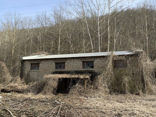
Ethel Coal Company Supply Building, constructed about 1914 by Italian stonemasons. The building served as a staging area for Don Chafin’s defensive forces in the Battle of Blair Mountain. 1 March 2020
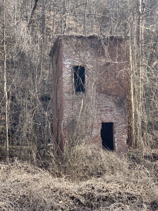
Remnants of Ethel No. 1 Company Store, built between 1907 and 1916. 1 March 2020

Brandon,
Thanks for all you do…this is great information…
Tell everyone howdy and stay safe
Duane ________________________________